Nach endlich abgeschlossener geistiger Verarbeitung nun auch die Anekdoten zum Trek in aktualisierter Langversion.


Nach endlich abgeschlossener geistiger Verarbeitung nun auch die Anekdoten zum Trek in aktualisierter Langversion.
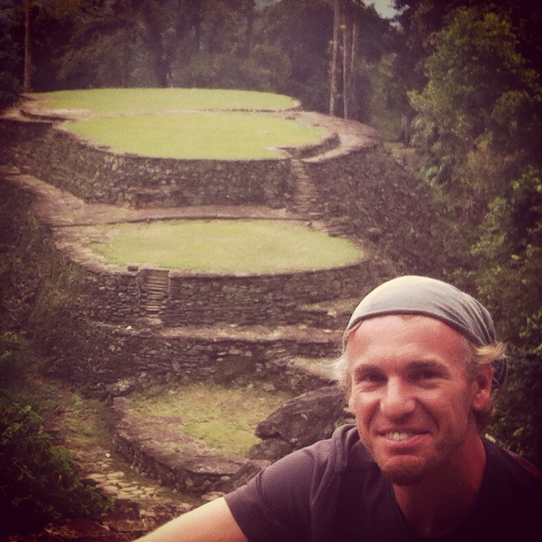
Verborgene Goldschätze sind naturgemäß schwer zu finden und selbst wenn man den Ort kennt nur mühsam erreichbar. 38 Jahre nachdem das letzte bisschen Gold aus allen Gräbern geplündert und der Entdecker aus lauter Habgier ermordet worden ist, kann man sich zwar die Machete sparen, aber einige Hürden sind trotzdem zu überwinden.
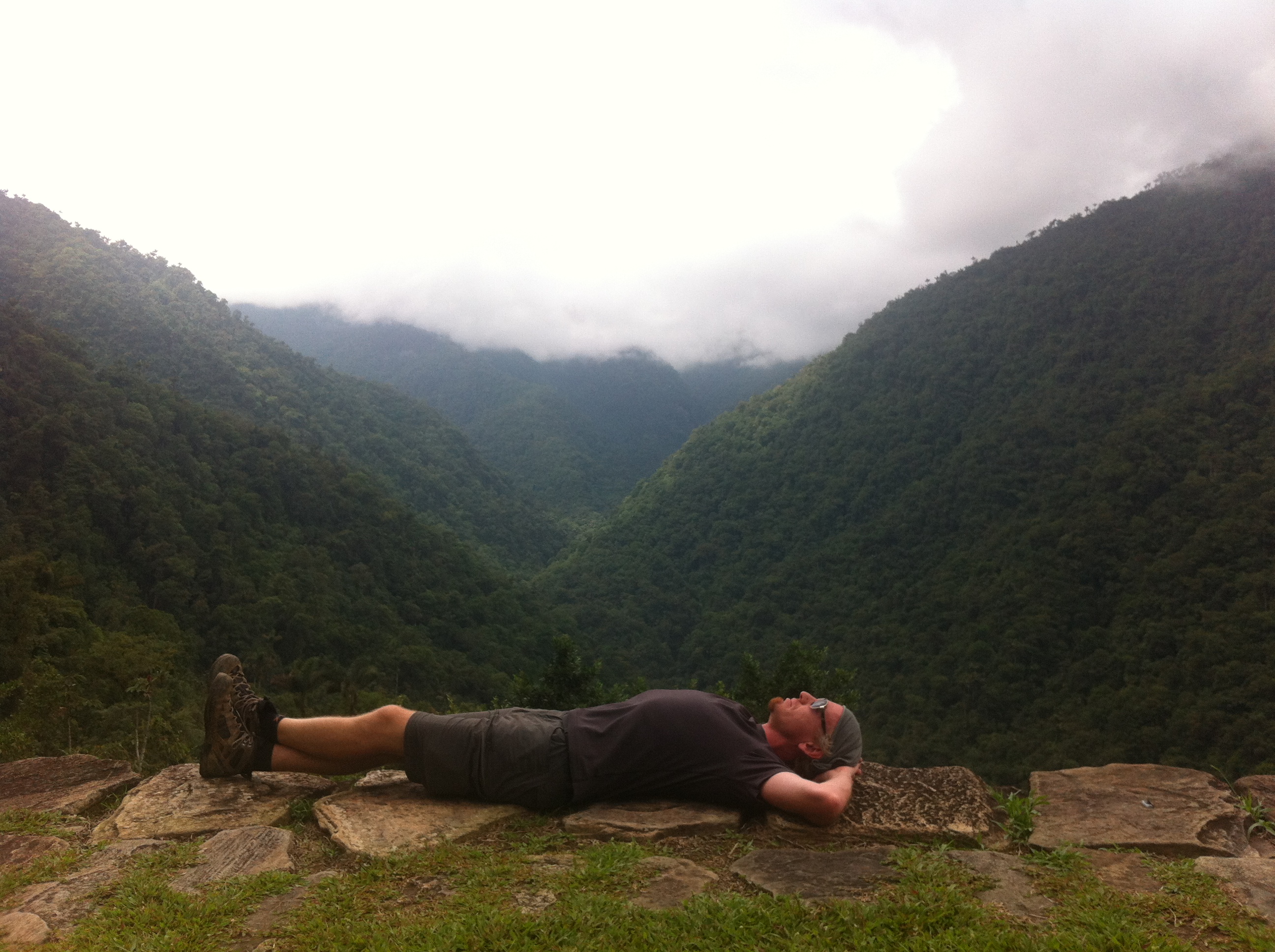
Um heute die verlorene Stadt zu sehen, muss man vier Tage ohne Strom und Handynetz auf steilen, schlammigen Pfaden auf sich nehmen und mit einem möglichst wasserdichten Rucksack, ein paar Mulis für die Verpflegung und wahlweise einem Campbett oder einer Hängematte im Freien auskommen.


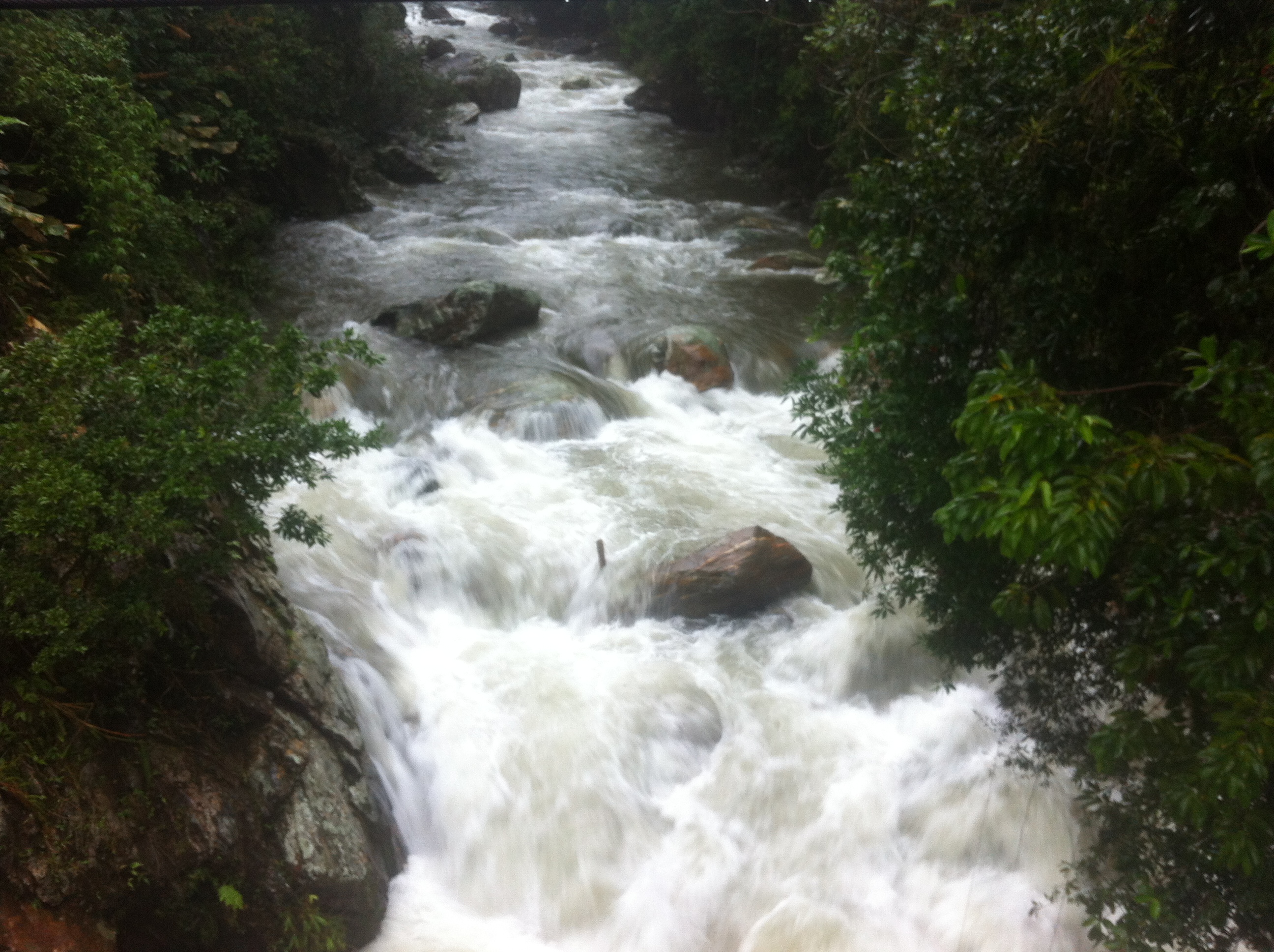
Die Schweine(-hitze) und die tropischen Regengüsse sind dabei nicht das Problem, klatschnass wird man hier bei JEDER Wetterlage. Allerdings führt der tropische Regen, wenn er allzu lange andauert, tatsächlich zu einem Hindernis. Er lässt den Rio Buritica, der auf dem Hin- und Rückweg je dreimal überquert wird, ziemlich schnell auf ein Vielfaches seiner normalen Stärke anschwellen und macht ihn zeitweise zu einem reißenden Strom. Das sieht bei der ersten Querung von oben noch recht eindrucksvoll aus.

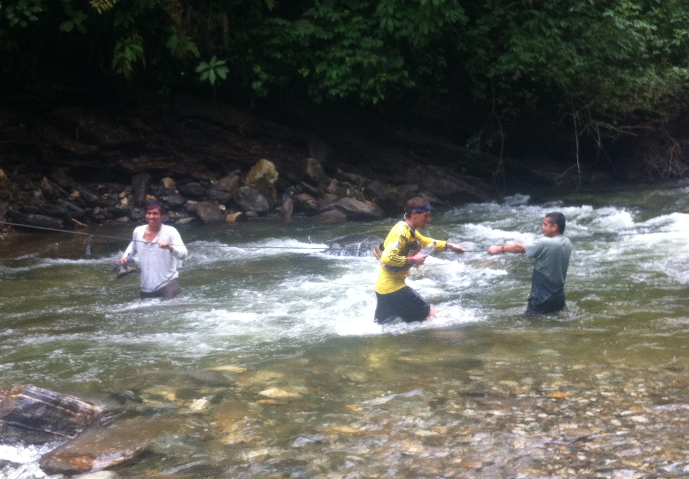
An den beiden anderen Stellen gibt es jedoch den Luxus einer Hängebrücke nicht mehr. Normalerweise wird die direkteste aller Überquerungsmethoden angewendet: Einfach durchgehen. Egal ob mit Sicherungsseil zum Festhalten (Querung Nr. 3) oder ohne (Nr.2) – man kommt nur durch, wenn der Fluss mehr oder weniger normale Höhe hat. Morgens ist das in der Regel der Fall, bevor der Regen einsetzt. Timing ist also alles. Auch das ist ein Grund, warum wir jeden Tag um 5 Uhr aufstehen.
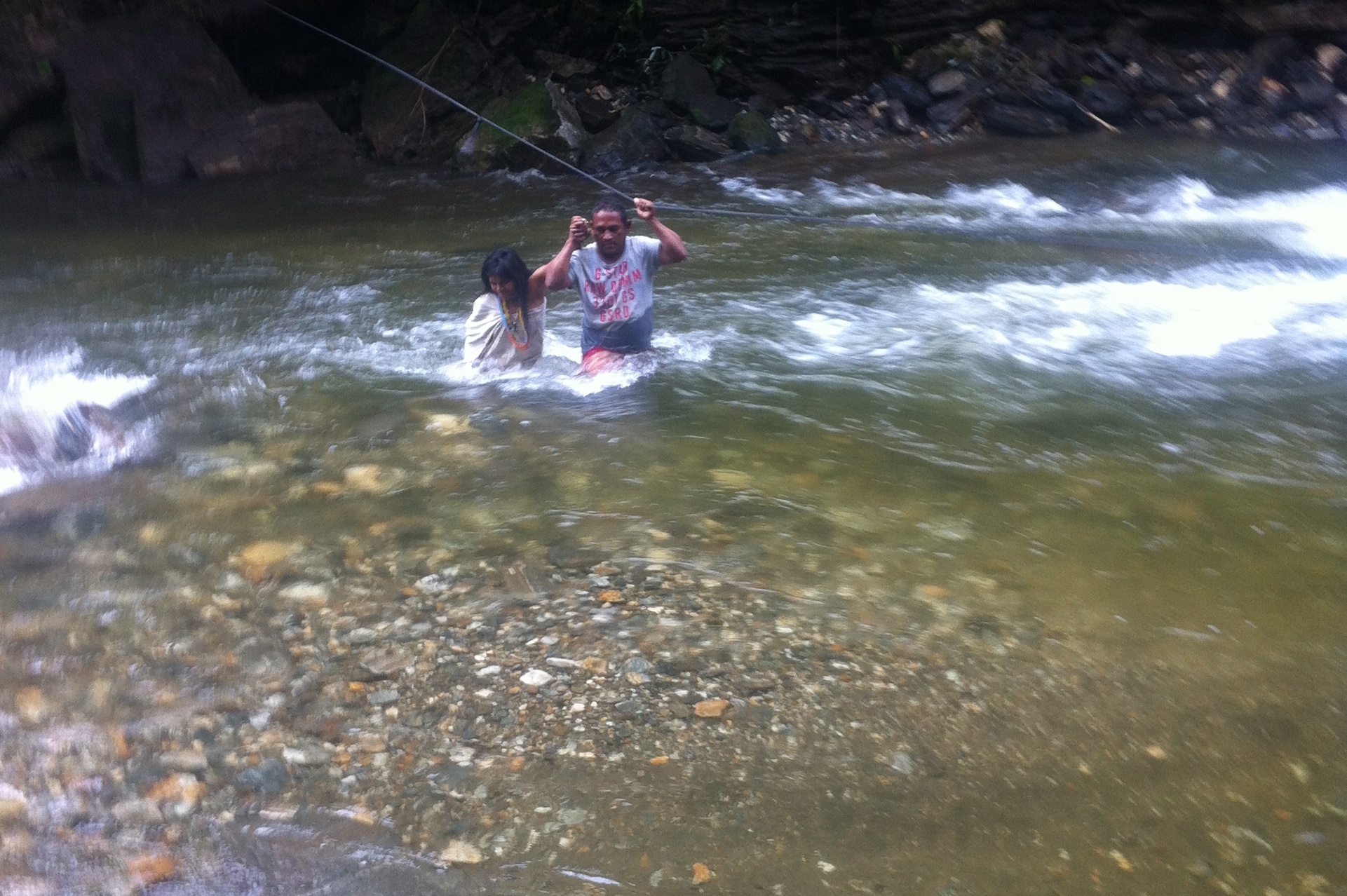
Aber leider ist keine Regel ohne Ausnahme. Auch das Wetter durchbricht gelegentlich den üblichen Tagesrhythmus. Tag 3 beginnt (wie immer um 5 Uhr) nach einer Nacht, in der es ununterbrochen geregnet hat. Der Rio Buritica ist um mehrere Meter näher ans Camp herangekommen als am Nachmittag zuvor. Wir brechen auf und es fängt sofort wieder an zu regnen, ich korrigiere: zu schütten wie aus Kübeln. Der Fluss ist zu Fuß unpassierbar. Es bleibt nur eine Option: die „Indiana-Jones-Methode“.

Einer nach dem anderen schwingt sich auf das offene Fahrgestell am Drahtseil und wird zwischen den nach wie vor gießenden Wassermassen von oben und dem rauschenden Fluss unten auf die andere Seite gezogen. Das Bild ist übrigens aus dem Internet geklaut. Mangels Unterwasserkamera fehlt mir eigenes Material.
Der Schlaf in den Nächten nach 8-stündigen Wanderungen mit viel Schweiß, Adrenalin und Abenteuer ist selbst im primitivsten Campbett so gut und tief wie selten. Um 18 Uhr ist es stockdunkel, um 21 Uhr kann kaum noch jemand die Augen offen halten. Bis ich plötzlich von einem eigenartigen Geräusch aus dem Traum hochgeschreckt werde. Es regnet und ich kann weder etwas hören noch sehen. Mit der Taschenlampe leuchte ich durch die Mückenvorhänge und sehe meinen Bettnachbarn friedlich schlafen. Er liegt auf der Seite und sieht in dem reflektierten Licht hinter zwei Vorhängen etwas gespenstisch aus. Ich leuchte nach draußen und sehe beim Hinunterblicken aus der hochwassersicheren oberen Etage der Stockbetten – nichts außer prasselnden Regen. Über mir: Ein Blechdach. Ein Tier vielleicht, dass sich unterm Dach im Trockenen eingenistet hat? Erkennen kann ich allerdings nichts. Ich schalte das Licht aus und lege mich wieder hin. Wenige Sekunden später erschreckt mich wieder ein plötzliches Fauchen, ein Zischen, das ein bisschen teuflisch klingt. Hilfe, hab ich schlecht geträumt und bilde mir das nur ein? Nein, ich bin jetzt hellwach und suche hektisch wieder die Lampe. Ich kann wieder nichts Auffälliges erkennen außer – da ist es wieder – Michael! Wie kann man denn so schnarchen? Der vermeintlich friedlich und leise schlafende Bettnachbar spart sich offenbar seine Atmung so lange auf bis der nächste Schnarcher klingt wie wenn ein tollwütiger Affe gerade einen Anfall hat.

Die Oropax liegen leider am anderen Ende des Camps im Rucksack, aber ich hole sie mir gerne auch mitten in der Nacht. Wenn ich dieses Geräusch noch weiter anhöre, träume ich später noch von blutrünstigen Löwen oder feuerspeienden Drachen.
Die Mühen dieses Trails haben sich auch ohne Gold mehr als gelohnt. Der kleine, quirlige Guide Gabriel war immer voller Begeisterung und hat 1300-jährige Geschichte der verlorenen Stadt leidenschaftlich vermittelt. Nach einem kleinen Plausch mit dem Schamanen der Kogis auf dem Weg hat er uns sprintenderweise sofort wieder eingeholt. Und keine Frage blieb unbeantwortet: „Mira, …“ und schon sprudelte er nur so los, dass der „Aushilfs-Übersetzer“ schwer überfordert war. Endlich weiß ich, warum ich selbst vorher im Spanischkurs war.
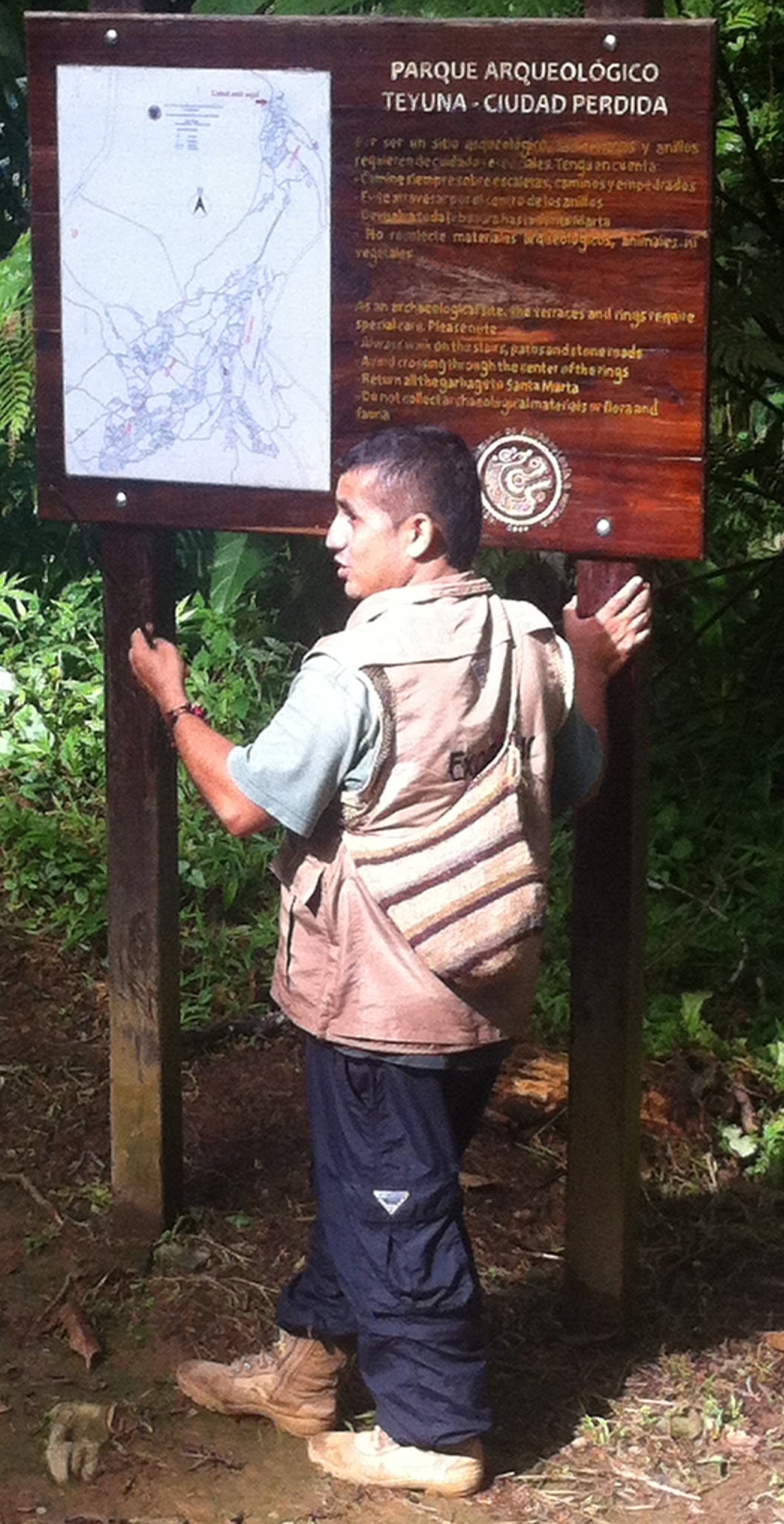

Und nicht zuletzt hat er uns alle sicher und wohlbehalten wieder in die Zivilisation gebracht – von den schwer eitrigen Blasen des Aushilfs-Übersetzers mal abgesehen, er war das Wandern ähnlich wenig gewöhnt wie das Übersetzen.
Schlechte Schuhe und merkwürdig schnarchende Mitwanderer sind am Ende eigentlich auch schon die größten Gefahren auf diesem Trek. Soldaten verhindern oberhalb der historischen Stadt mögliche Geiselnahmen von Guerillas, müde und fußlahme Kollegen chartern sich im Notfall einen Esel, vor dem Verdursten kommt mit Sicherheit der nächste Platzregen und die Überlebenschancen am Ziel selbst sind heute auch deutlich höher – seit es nichts mehr zu holen gibt und deshalb auch keine habgierigen Grabräuber mehr zur „Ciudad Perdida“ in der Sierra Nevada de Santa Marta unterwegs sind.
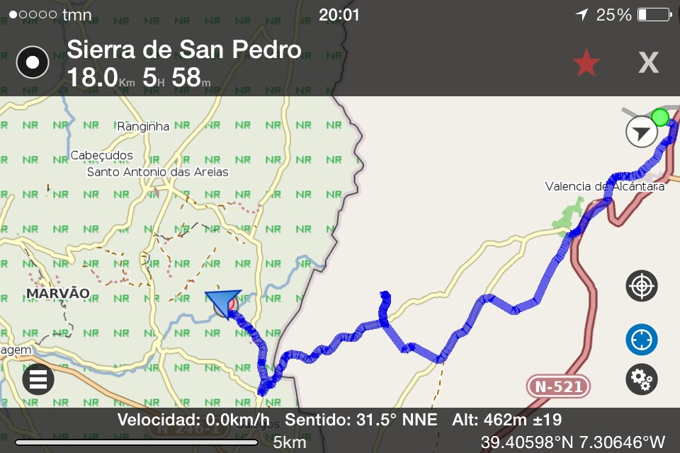
There is only one train per day going to the Western end of the Spanish railway Network in the Extremadura province. The final station is Valencia de Alcántara, a small town in the middle of nowhere. Around ten people descend the train and disappear. When I start walking away, the station, the place in front of it and the street leading into town are deserted. No car, no people, nothing. This is a good point to start a three-day hike into wild nature. This is the end of Spain. I want to see how it is on the other side of the border in Portugal.
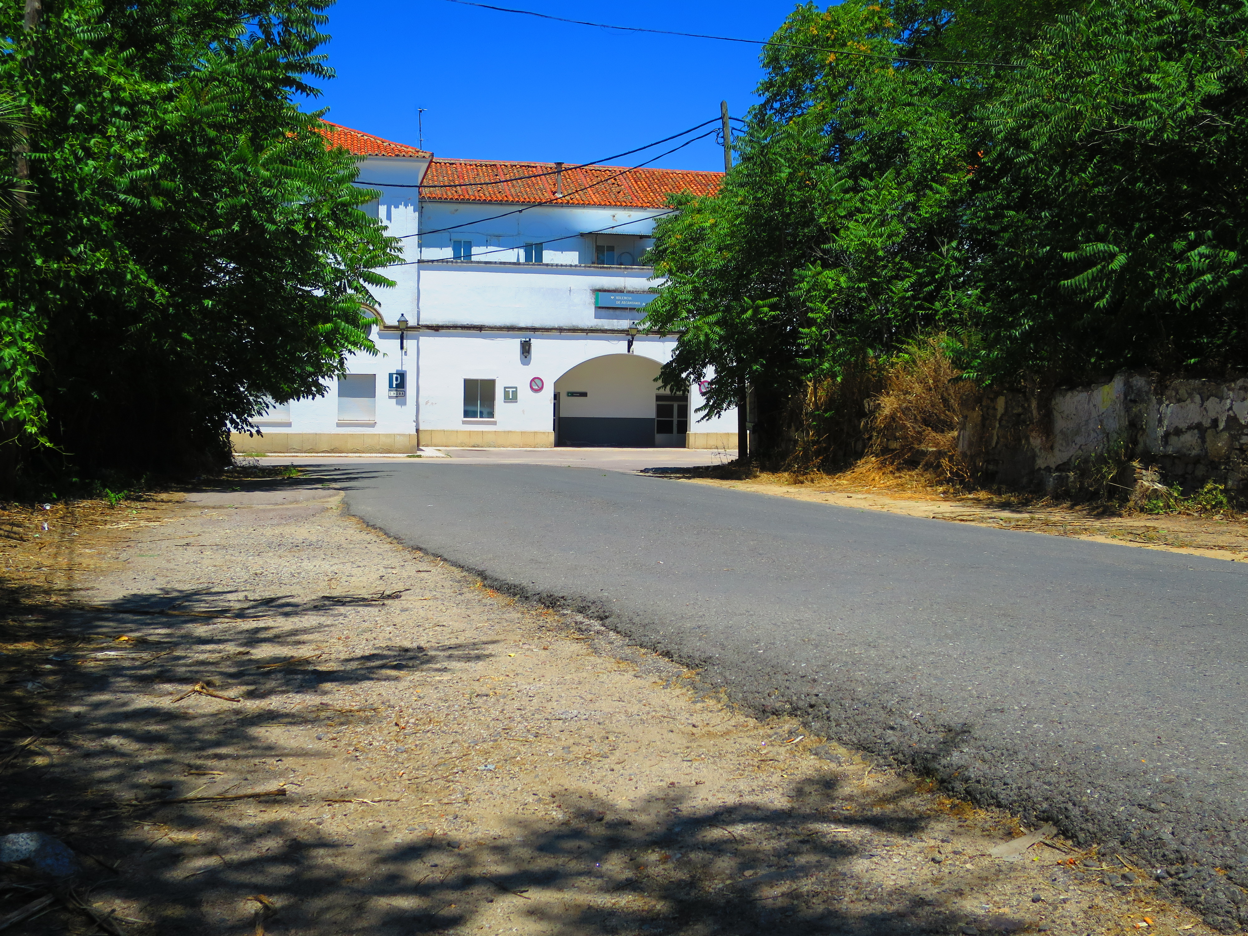
Every shop as well as the tourist information in Valencia are of course closed due to siesta time. Water and bocadillo out of a bar must make the supplies for now and the downloaded smartphone maps will hopefully be sufficient. Local people (including research workers in an office and Guardia Civil officers) are trying to be helpful, but in terms of navigation material the only usable hint points to an information board at the trailhead behind the village that I would have passed by anyway.

It is 32° hot, almost 4 in the afternoon and we haven’t even started the major portion of the trail through the nature parks of „Sierra de San Pedro“ (Spanish part) and „Serra de São Mameda“ (Portuguese part). So we go along as fast as heat and sensational views of the area permit. A first century Roman aqueduct and a goat on top of it break my digital camera. Ok, not exactly, I drop it on the ancient stones trying to do the drinking, dog-watering and picture-taking at the same time. The Roman aqueduct is indeed tougher. That’s why it lasts a bit longer than a twenty-first century Japanese electronic product.
Before: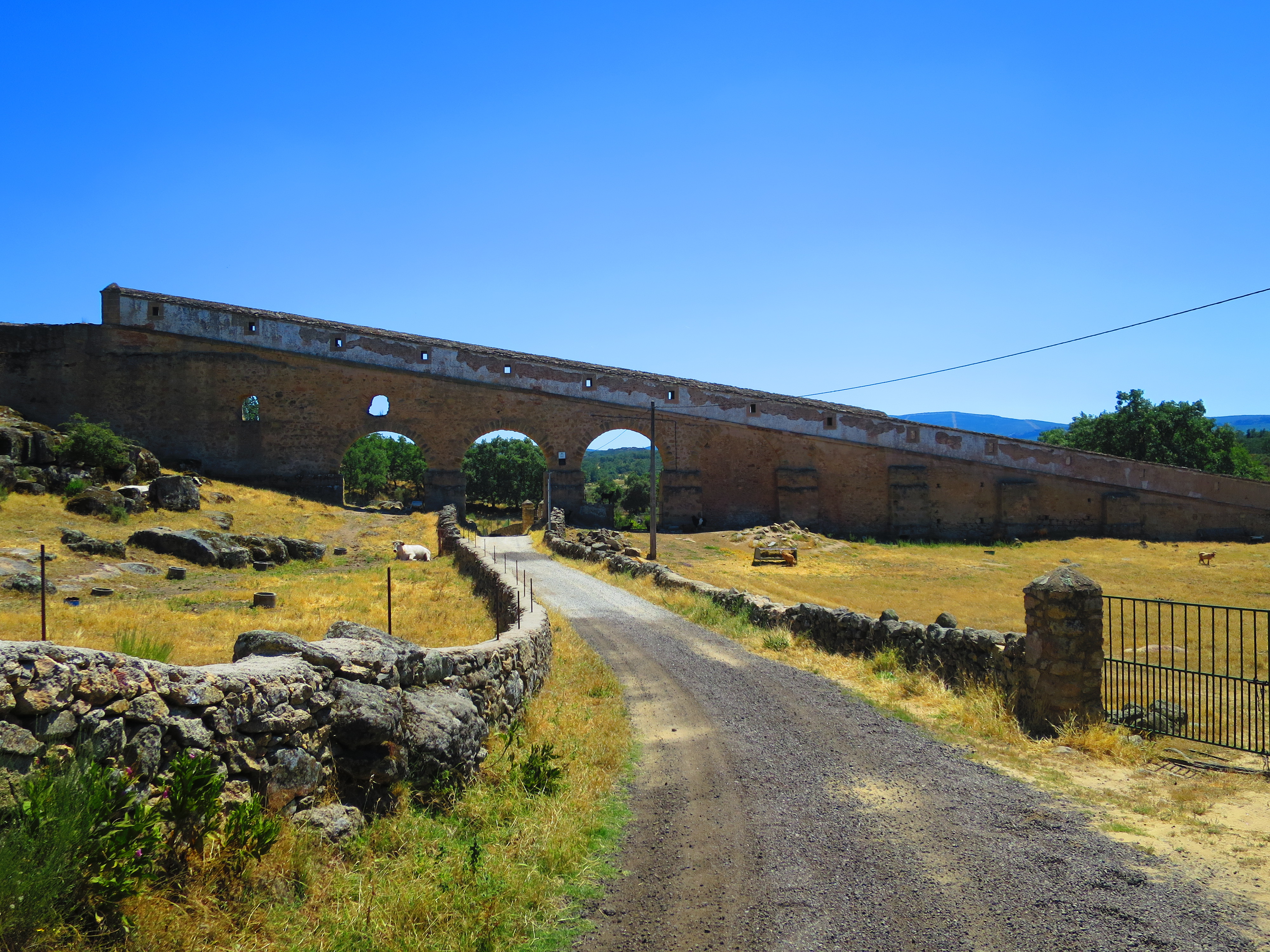 and after:
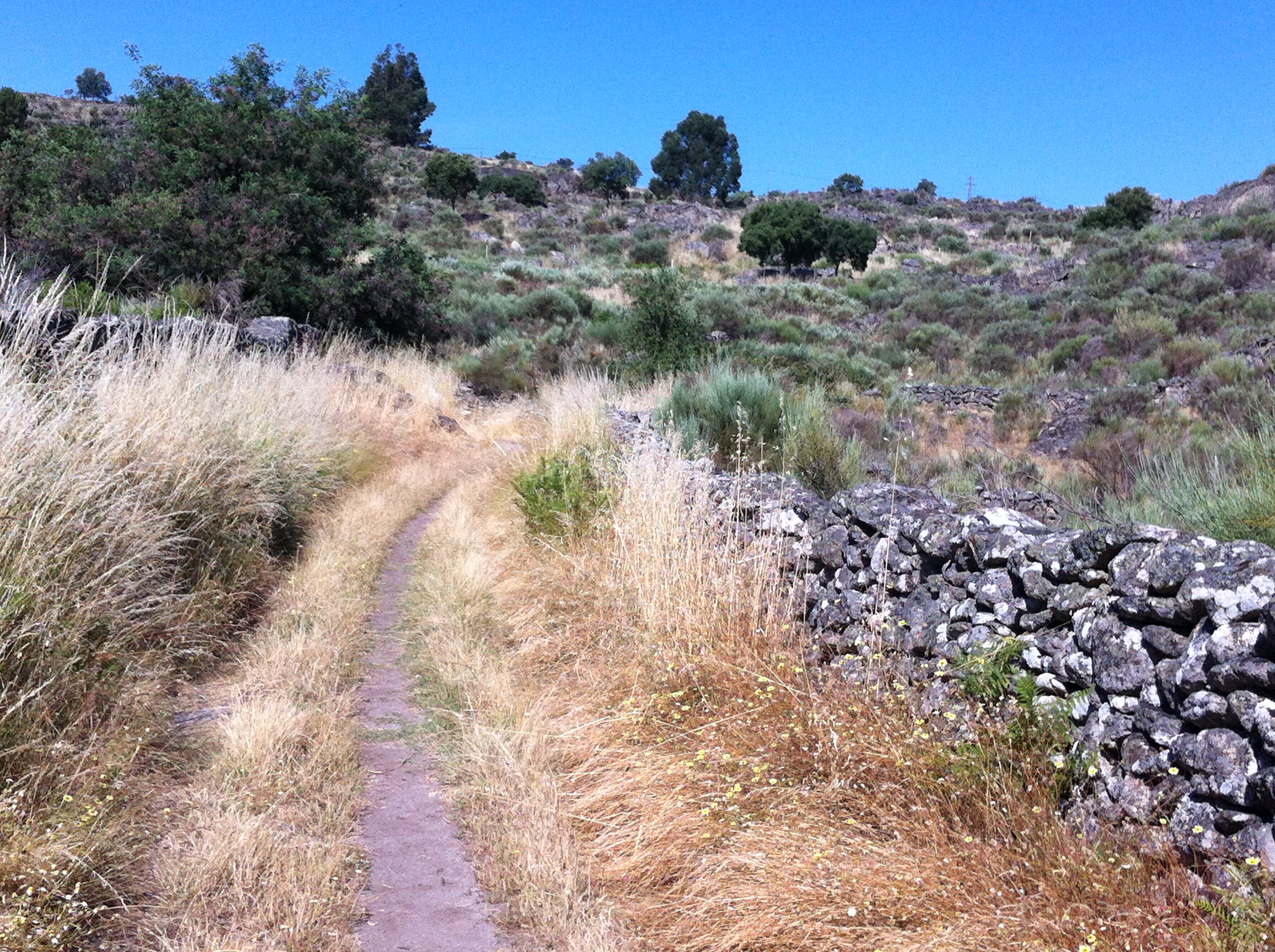
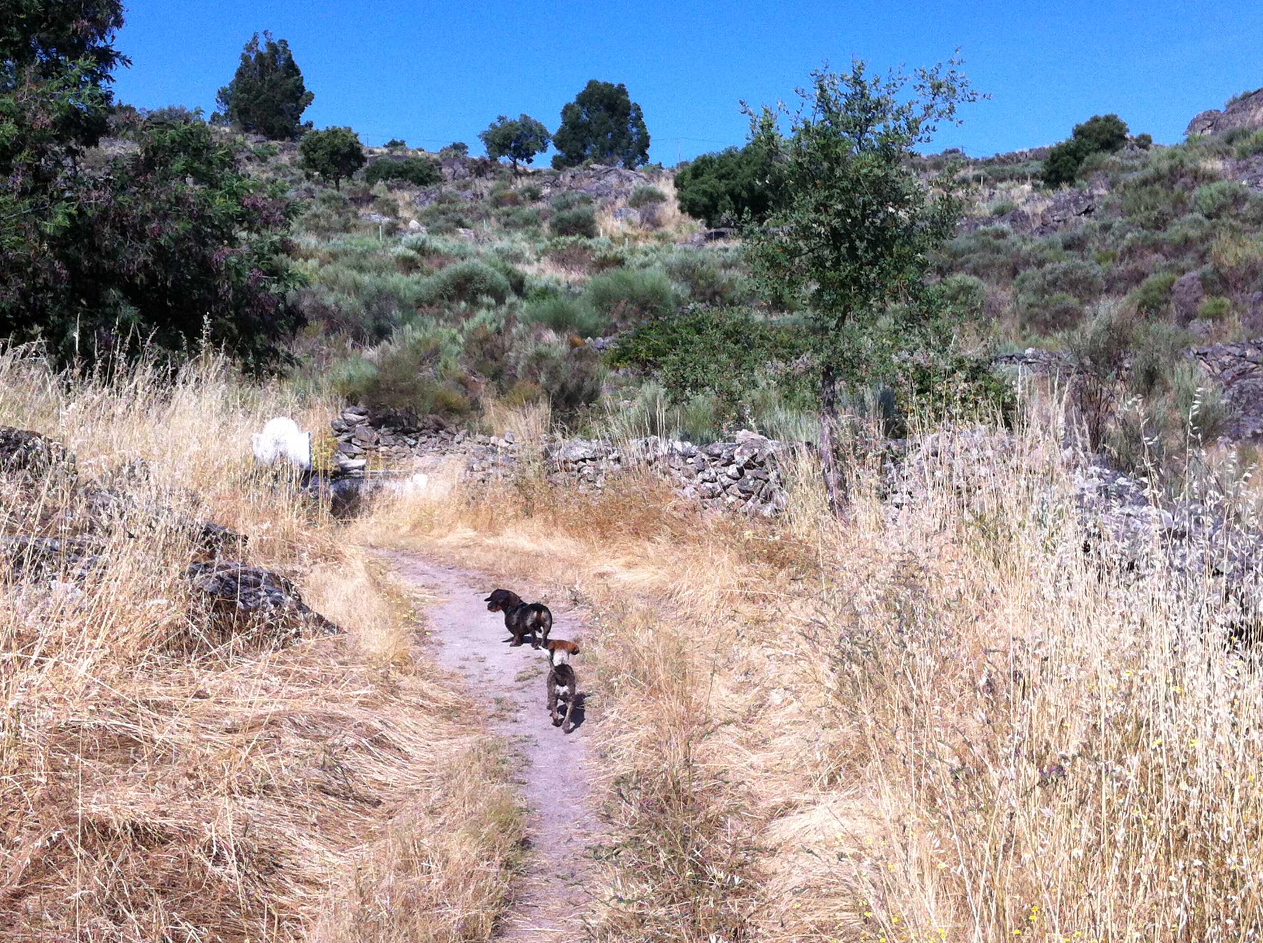
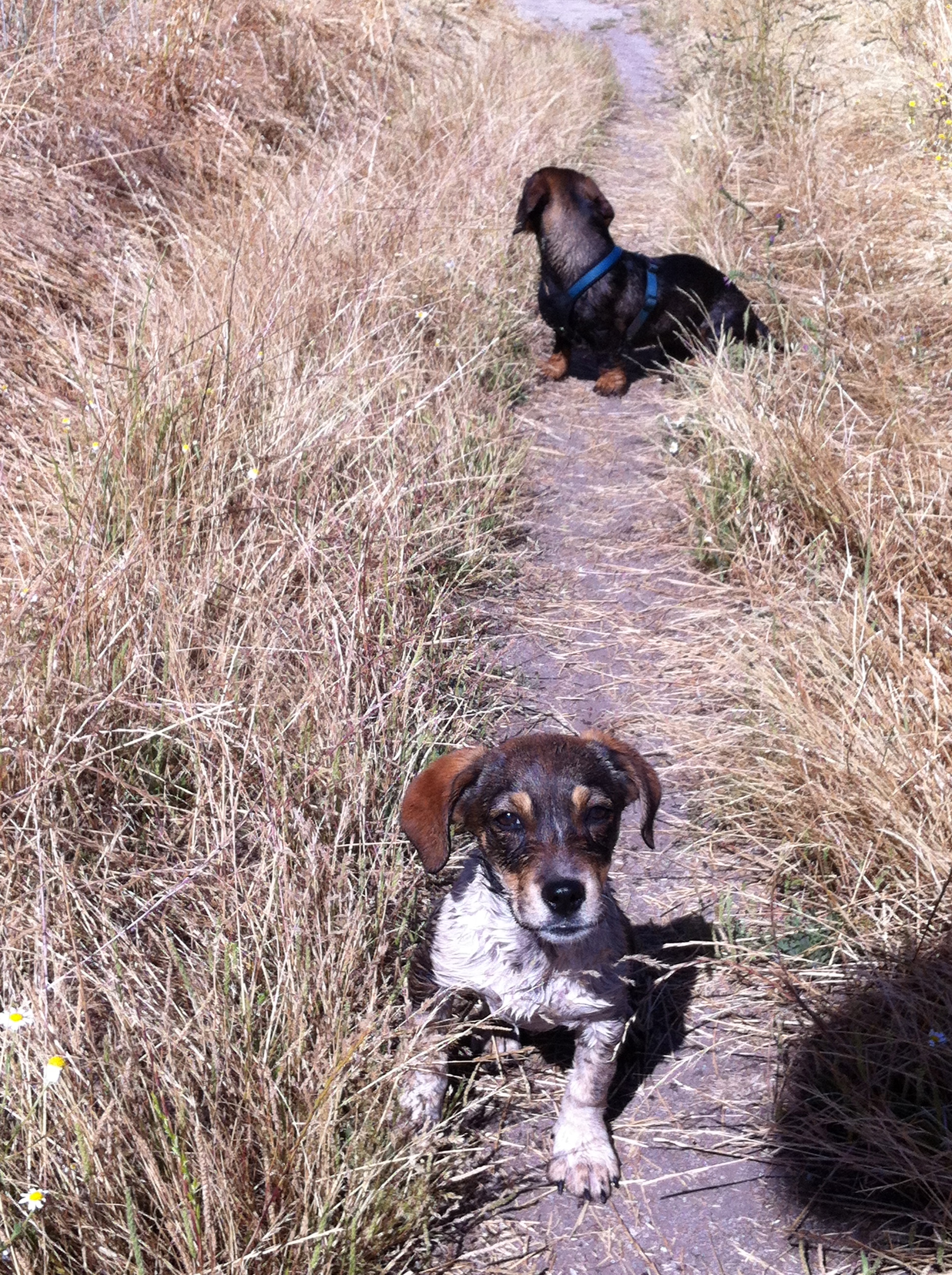
Impressions are to be taken to the mind anyway and not to a microchip. So, no worries. Arriving before sunset is now more important. Scenery becomes even more stunning, the mountain-top village and castle of Marvão appear and lead us into the right direction. Dolmens in the middle of fields remain as everlasting symbols from ancient cultures. Crystal-clear rivers and creeks become more frequent the closer we get to Portugal. The dog jumps in in order to cool down. Me too, almost. Behind a little stone wall I can hear a boar grunting and see the bushes moving, unfortunately I can’t see it. I guess this lonesome area is rather being claimed by wildlife than by men. A wild living here is not only performed by deer and fox, but also by some dog puppies. In the very last hamlet right before the border (La Fontñera) we meet one of those and she decides spontaneously to follow me and Zenz (my dog) for the next two days.
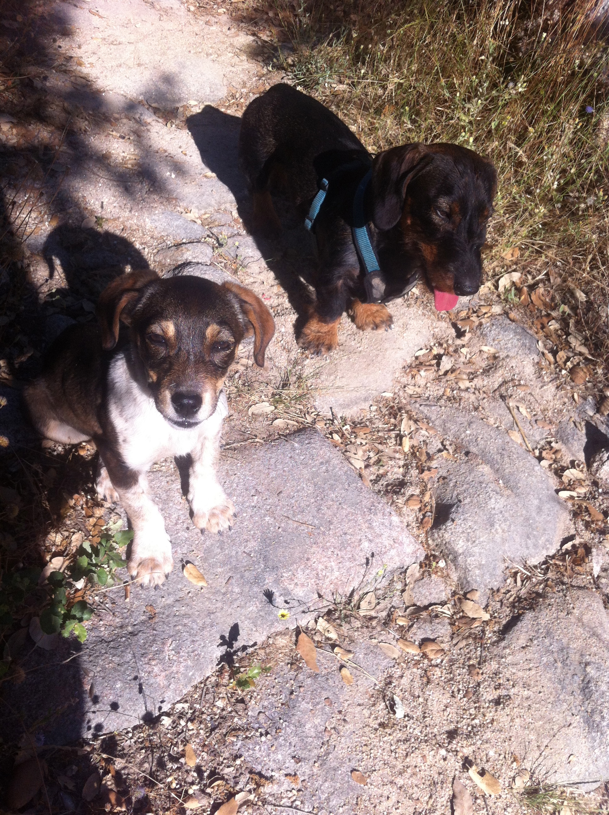
The very few people on the street that I run across on the Portuguese side don’t know anything about the home of this gipsy-like puppy. „Agora tenshsh doishsh….“ (or something similar) are the only words I can identify out of the soft-hearted Portuguese mumbling. It seems I now have two.
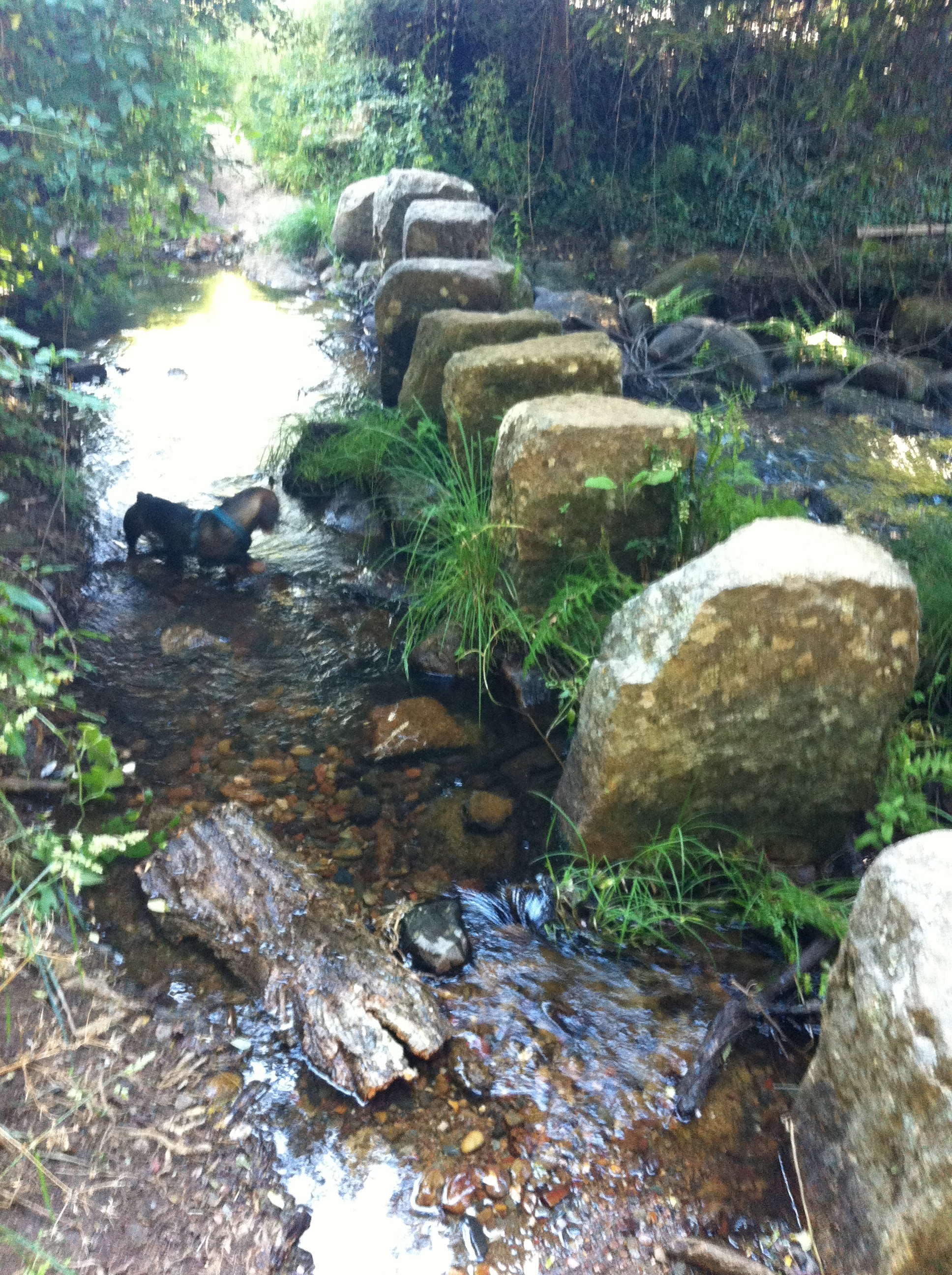
The three of us descend into the valley of the Rio Sever and now the surroundings really become magic. Lush greens everywhere, the waters are traversed by tiny bridges or just by stone blocks. Vultures in the sky, waterfalls rushing. A green snake next to the path hides quickly underneath the leaves when we pass by. It hopefully stays on this side of the river while we sleep on the other one.
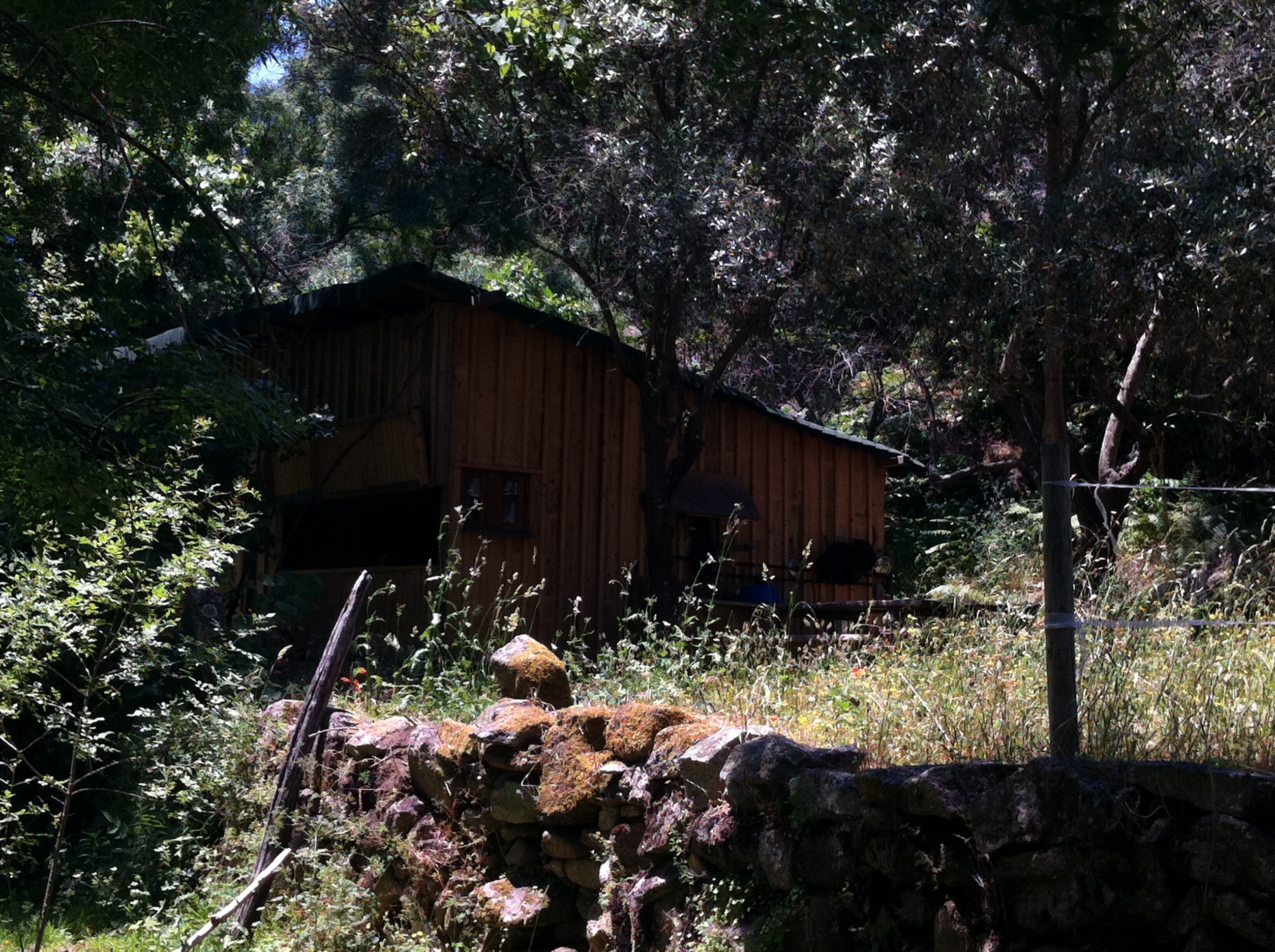
Finally, the farm Pego Ferreiro of the British couple Richard and Cathy appears. Or at least the entrance of it with one of the guests‘ houses. It takes me a while to find the other end of the farm and Richard. But in between I encounter all the animals that I will take care of on the next day, while the landlord will be in Lisbon.
He is a very uncomplicated, friendly guy and – very generous of him – he will let me sleep two nights for free in my own private little hut, fully equipped with all you need to survive and sleep conveniently. All I have to do is water and feed the horses (several times, it’s hot), let the chickens out in the morning and lock them up in the evening and feed the dogs. Well, no problem, I’ll play the part-time farmer deliberately.
Since my food supplies are kind of minimalistic thanks to the ubiquitous siesta in Valencia (the only village I passed that even had any shops), Richard helps me out by harvesting whatever his gardens already have at this time of the year. Probably this was the eco-friendliest day I ever spent: Travel by foot, drink water from the well, eat vegetables from the garden, cook them on fire of wood collected from around the hut. And nothing is really missing, when you’re out here.
The next day shall be an easy one: Look after the farm animals as instructed. Go to the next village and buy some food. Have a nice barbecue. Relax in the hammock. End of day. Considering that food shopping by foot from here takes almost a half-day trip anyway, this should be enough on the agenda for one day.
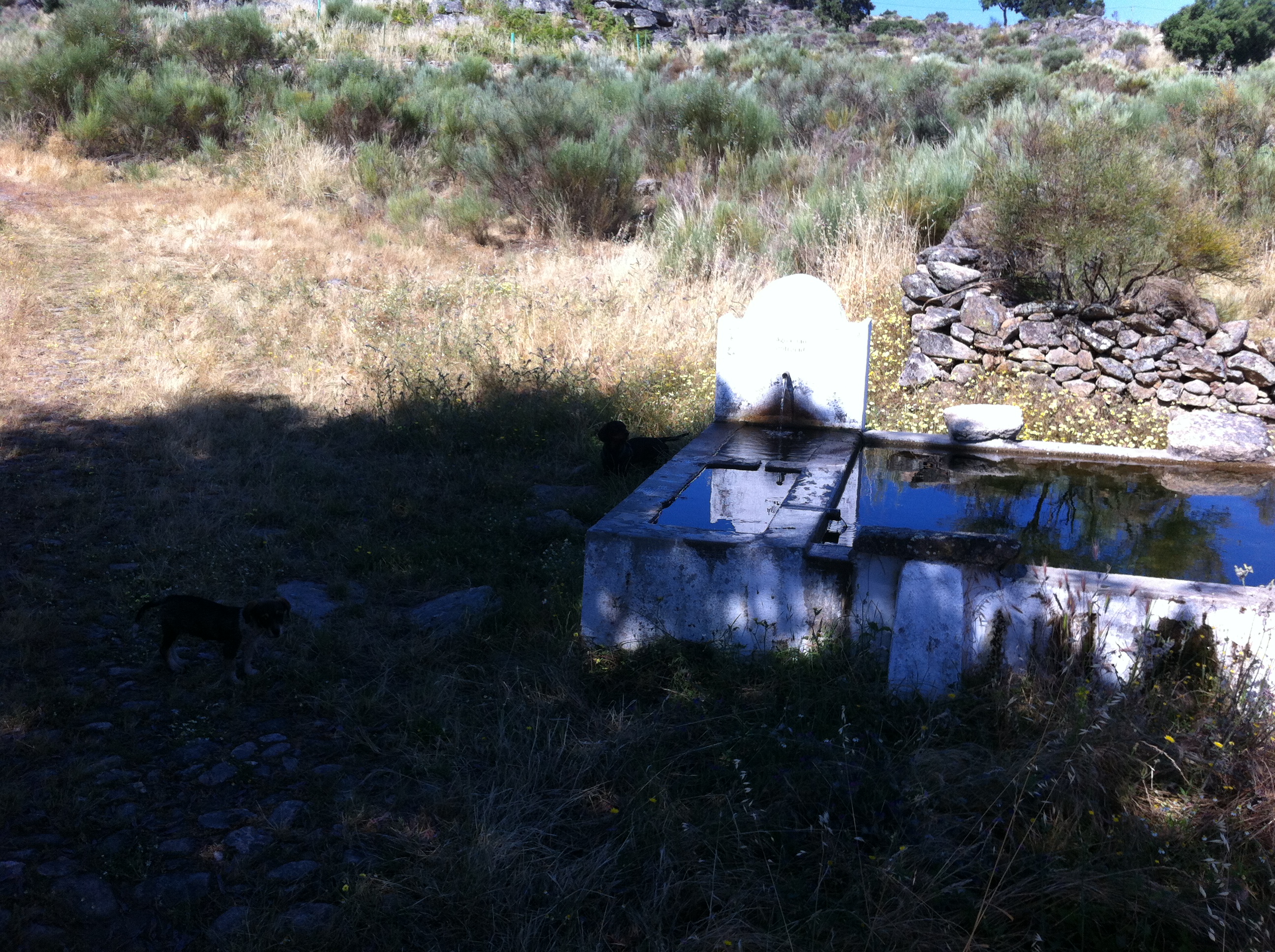
One nice thing on Portuguese footpaths: When it’s hot and you’re in the middle of nowhere and you’re begging for some fresh, cool water…..
….. a fountain appears right in front of you:
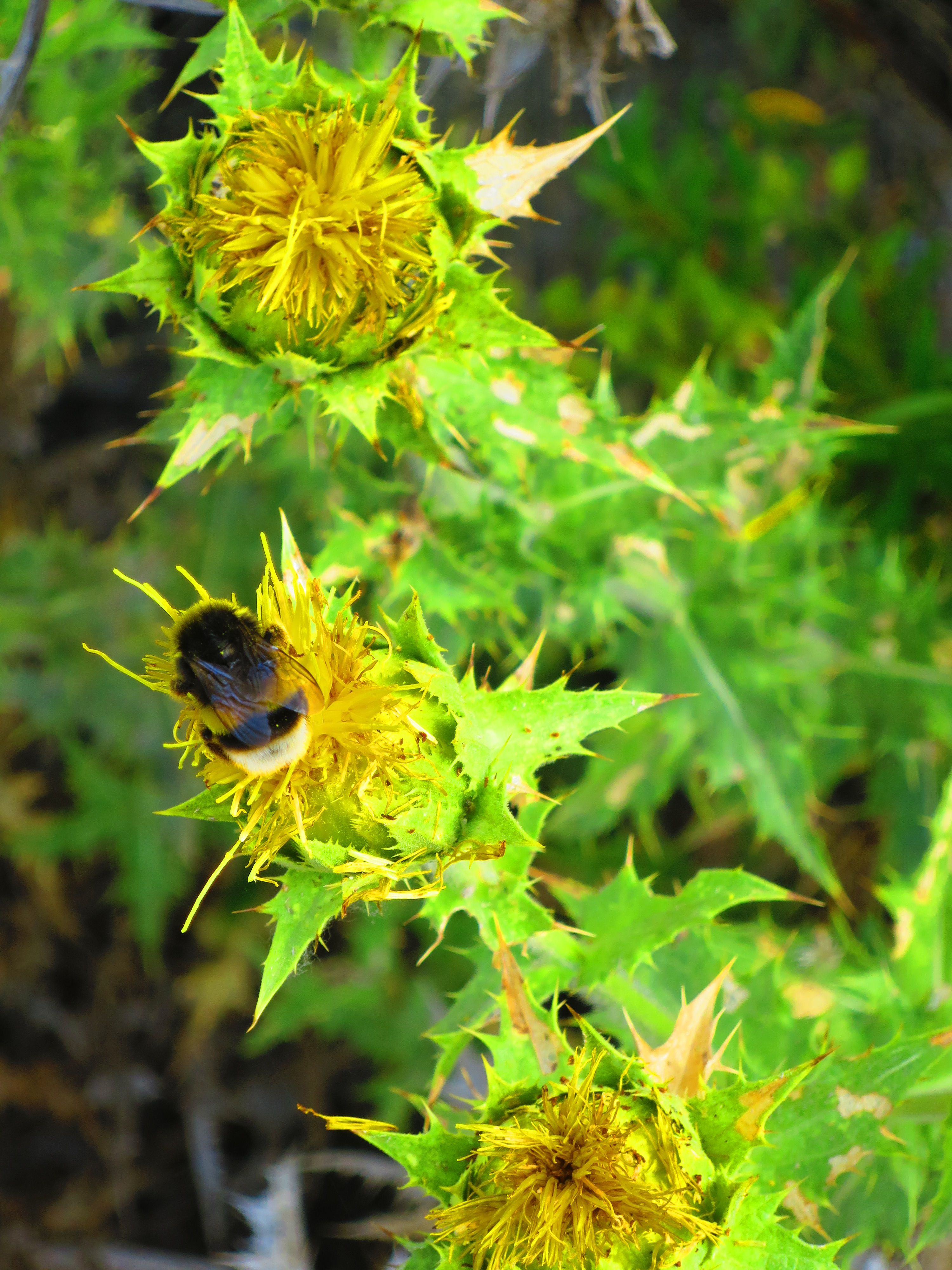
And it’s really perfectly cold water sputtering out of it (lots of bees like the water also, that’s the only drawback):
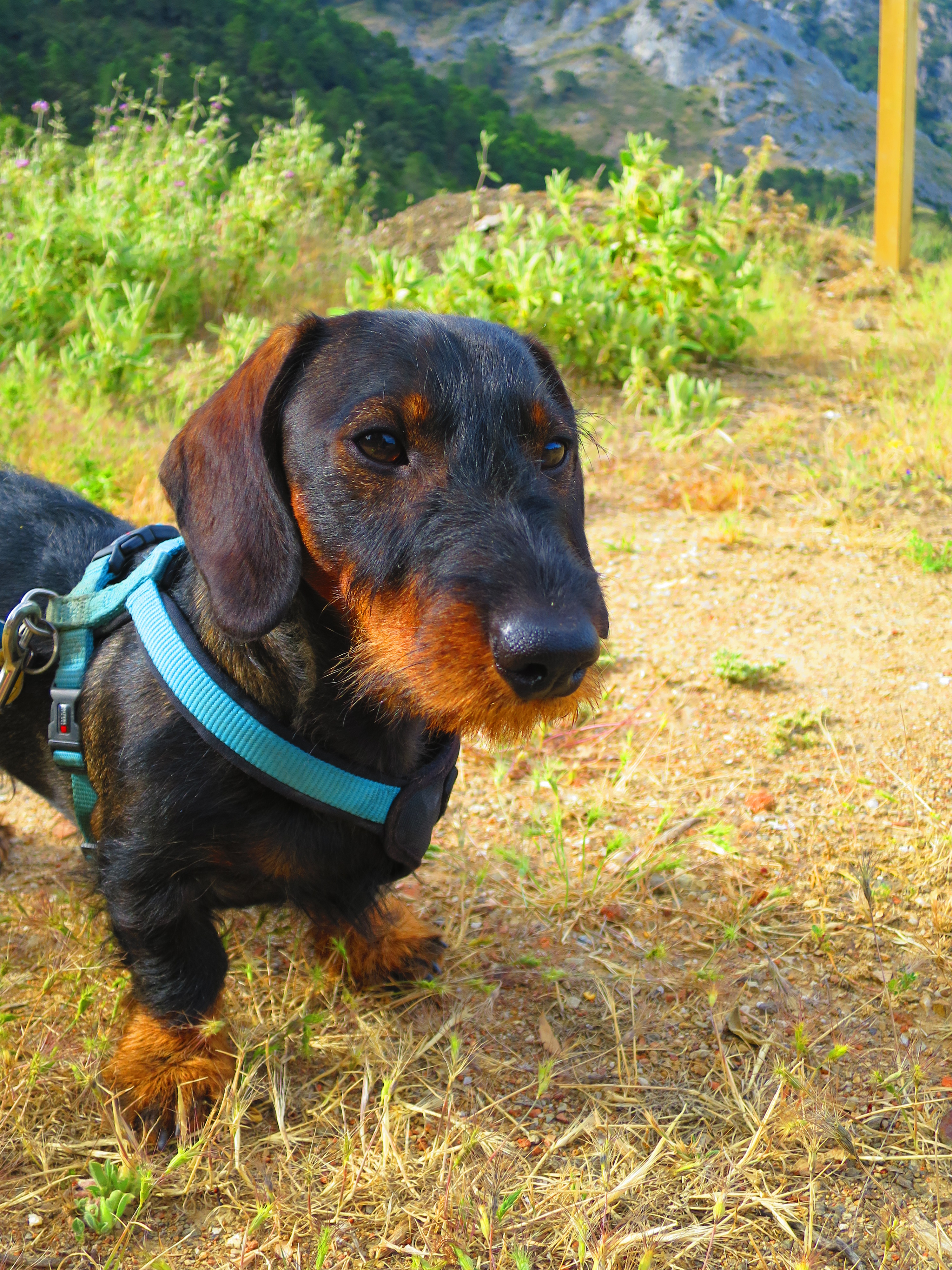
The two dogs – yes, the little gipsy bitch is still with us, I named her Alicia in the meantime (as she is Spanish, I believe, or Portuguese?) – enjoy their freedom in this remote place. No need for a leash. There is no car for miles and they find their way around anyway. On Richard’s and Cathy’s farm they are even very friendly with the other dogs, the chickens and the horses. This place calms everybody down. Similar to his first encounter with a turtle last week, Zenz looks very surprised, but nosey – as always – when he meets a snake for the first time and barks at it. Better go away from this black beast and be careful! The snake stayed underneath our outside table next to the hut for a while. Then it’s gone again and I start the barbecue which will hopefully scare any other unwanted guests away.
Alicia, Zenz an I share what the local stores in Santo António das Areias had to offer: Perfect meat from the butchery, fruit and cheese from the grocery, pasteis from the bakery. Alicia eats everything and as much as she can – well, with the exception of the pasteis maybe….., Zenz envies her and tries to eat just as much, and I eat what’s left. Does the hungry dog even keep food in his cheeks? He looks different. Or is it a bee sting? I look at him closer. His lips are swollen, he must have tried to catch a bee again. He did that before with the same result. I can’t do a lot for him out here. A little cooling, a little bit of rescue drops on it. That’s all I have at hand.
Two hours later all of his neck and chin is swollen – an allergic reaction obviously. But too late to give him medication that I carry with me for myself – he won’t take anything anymore. It’s getting dark, when he becomes more and more lethargic. I have to go to a vet as quickly as possible. None of the other guests seems to be home yet and Richard won’t come back today. I leave a note at the neighbors‘ door and send a text message to Richard asking for the address of the next vet. It turns out that nobody was coming home that night and Richard’s number was wrong. I am all alone, miles away from everything.
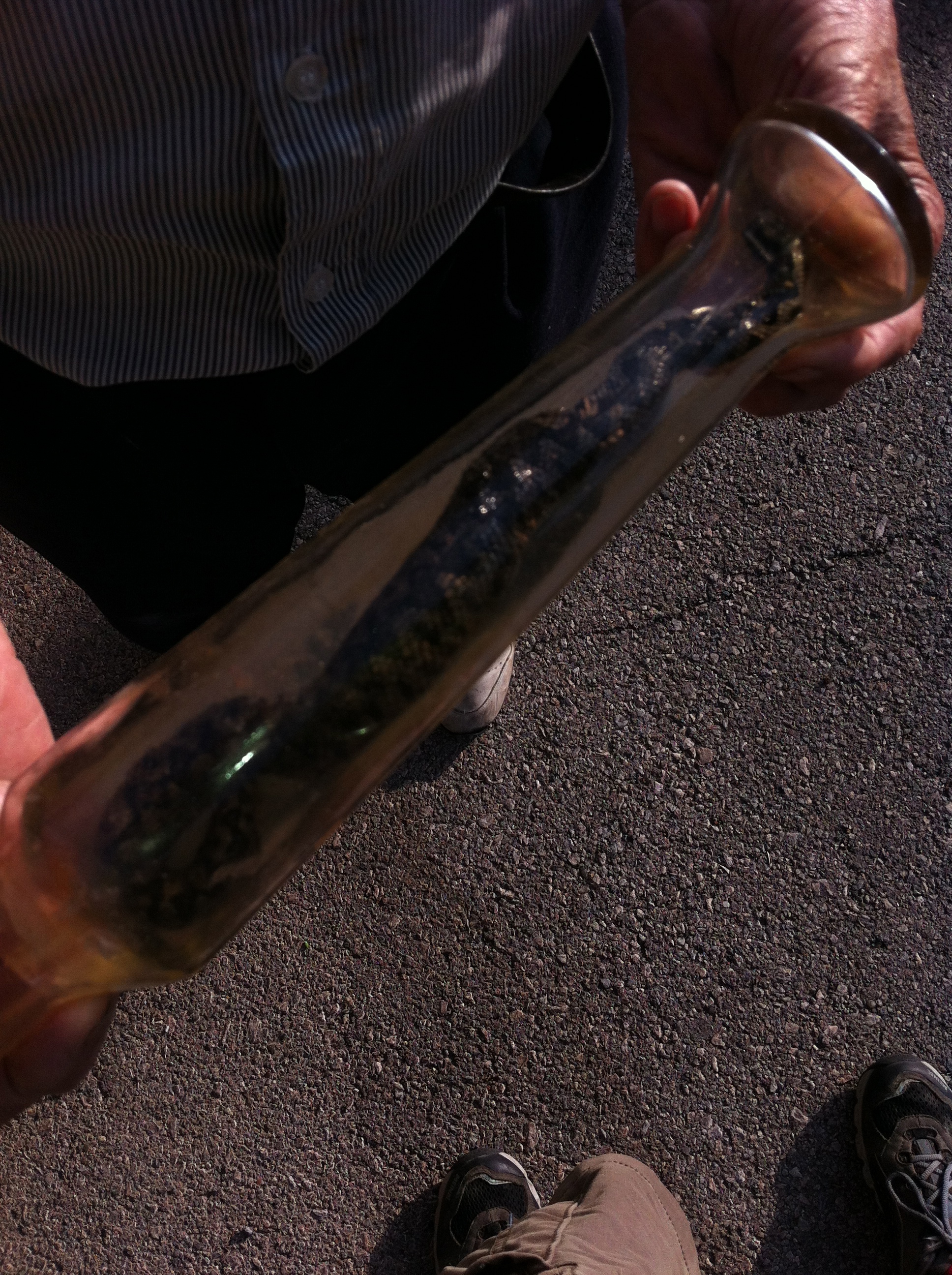
The dog is still breathing the next morning, but he lies in the darkest corner underneath the bed and doesn’t move. His head and neck look like pumped up. With sunrise I pack up my stuff, put Zenz on my shoulder and start walking back. Alicia is following. Feeling how weak he is and trying to rethink where and when that bee stung him, the thought suddenly flashes me: THE SNAKE! Of course, this was no bee. The snake bit him. When he barked, this nasty beast had already bitten him. We need to be quick now…..
The first and only vehicle I encounter after almost one hour of walking is a waste truck. They can’t help me, have no place and time to take me anywhere and no cell phone or number at hand to call anybody. 15 minutes later a passenger car with a young guy just as helpless. When he goes on, I see that he just drives to the neighbor’s house and stays there. Interesting – there’s either no car at all or one that is only being used within the village limits. I keep on walking up the hill and cross the border to Spain again. It looks ghostly empty at this time in the little village of La Fontañera and its maybe 50 houses. But there is one old man out on the street doing something on his garden fence. I tell him what’s happened and that I need somebody with a car. He shrugs and points to the other end of the village. Most people have no car here. But he’s very interested in the type of snake that bit him. I try to describe it hoping that a little more information that I get from him might help later, if passed on to the veterinarian. He shows me his own trophy, a viper conserved in a glass. Besides a darker, almost black color it looks kind of similar to the one that bit poor Zenz. I try to end the discussion, especially since I don’t want to hear more things like „Tiene que morir…“. If not treated after 3-4 hours, he will have to die, the old man says. Nothing against the experience of older generations, but I won’t give up so quickly. We won’t give up.
An alcoholic with bloody red eyes and a severe shaking in his hand appears on the other side of the street. I don’t even finish the question, he has other problems to solve….. Then a surprisingly young and healthy guy for the average of this village walks up the street with a bottle of water from the well – a German tourist named Markus as it turns out, coming here frequently for personal connections and for mountain-biking. He takes me with his rental car to Valencia, I find a veterinarian (in the middle of a surgery on a cat, which requires another 30 minutes of patience) and almost 18 hours after the biting Zenz gets his first treatment. He is hardly moving during the four injections he is given.
Three days later he’s fortunately much better and starts hunting birds and all his other bad habits again. Tough little guy. I don’t want to know, if I had coped with a snake bite in the outback this well.
***
NOTE: This entry was written in English in order to give Richard and Cathy the chance to read how adventurous my stay at their place was. Nevertheless, Pego Ferreiro has a fascinating, almost mythical touch of paradise. A nasty little snake will not be able to disturb this. But watch your steps in the woods. And your pets, if they love to explore as mine does.
Strecken:
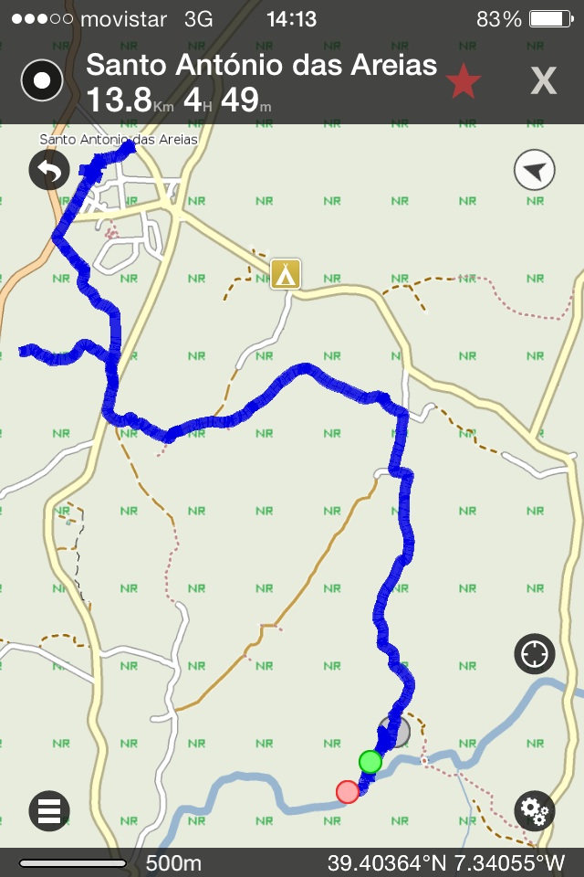
Valencia de Alcántara > La Fontañera > Pego Ferreiro, 18 km
Pego Ferreiro > Santo António das Areias > Pego Ferreiro, 14 km
Pego Ferreiro > La Fontañera, 5 km
Höhenmeter:
200
70
80
Fazit:
Faszinierender Flecken Erde, aber leider nicht ohne Gefahren.
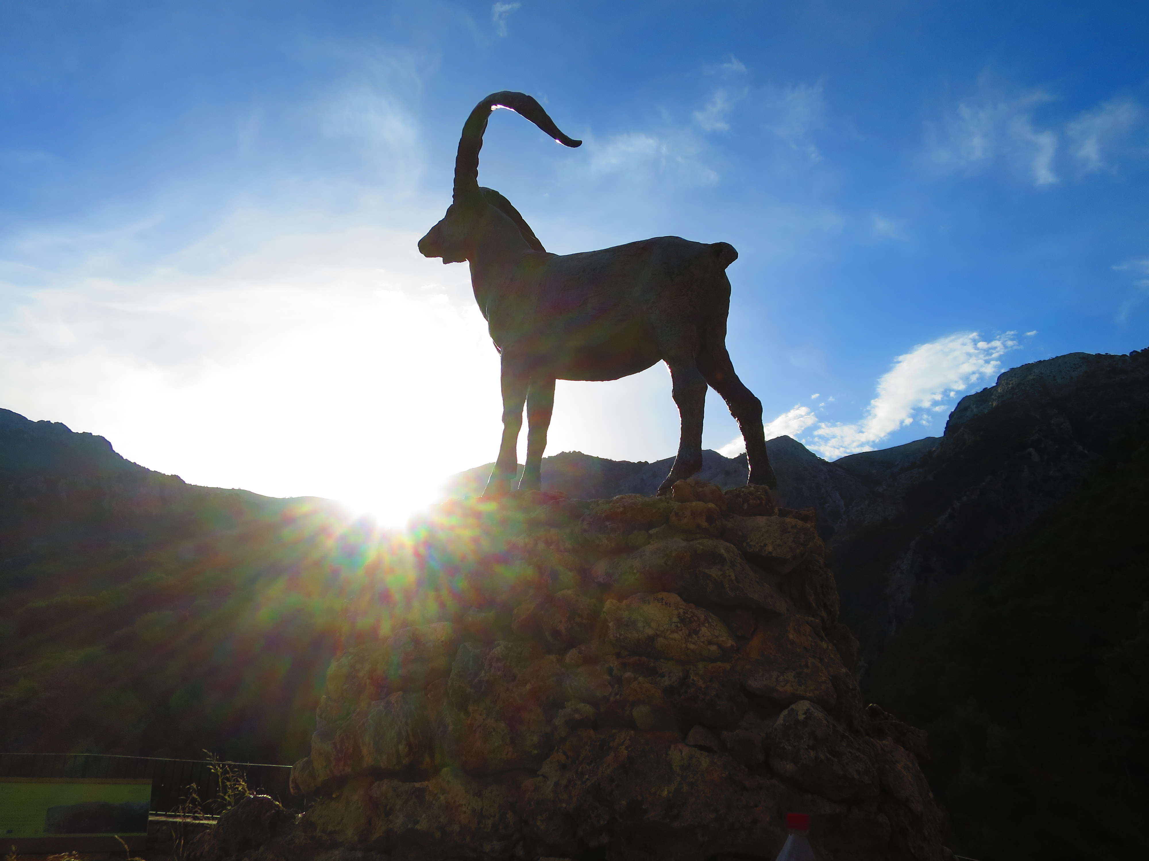
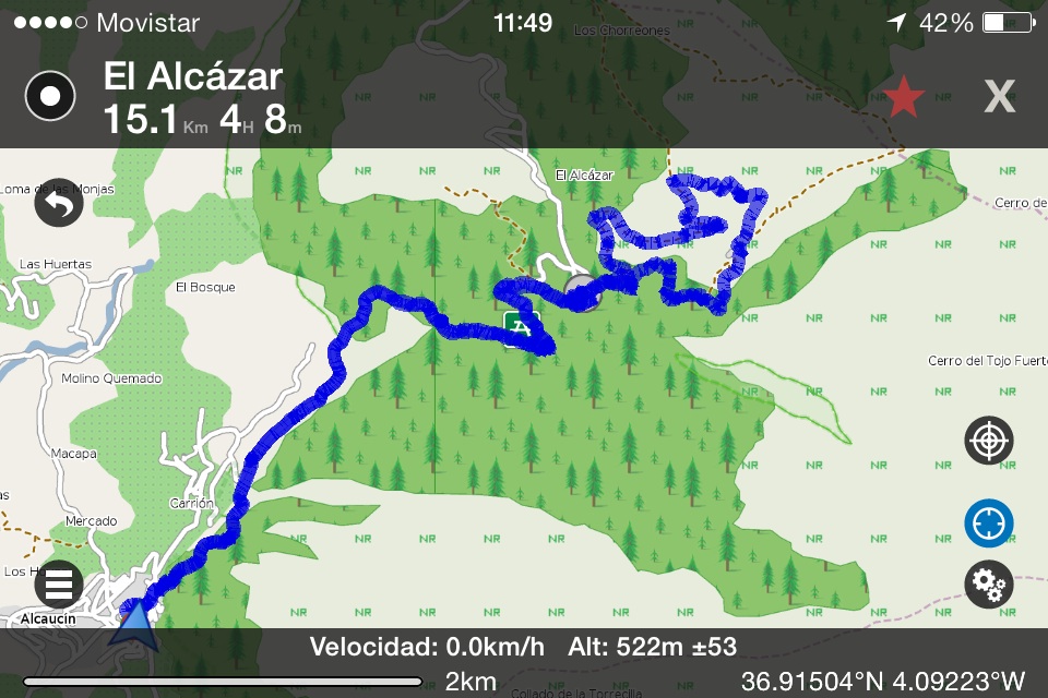
Strecke: Alcaucín > El Alcázar > Ruta Botánica > Alcaucín, 15 km
Höhenmeter: 600
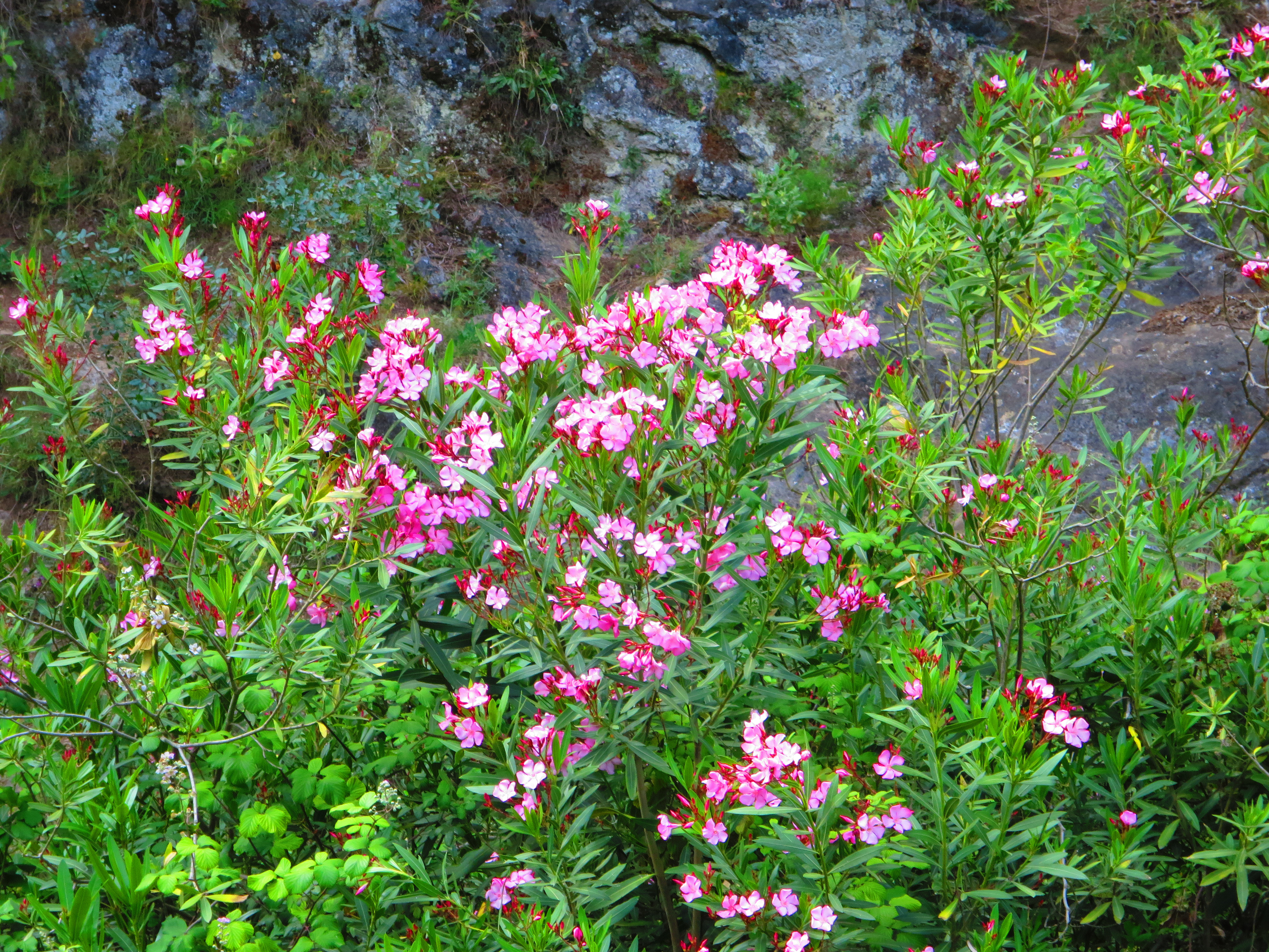
Fazit: Die Sierra de Tejeda lässt sich nicht lumpen, was Wanderwege, Gebirgsbäche, Bergkulisse, Flora und Fauna angeht. Und zurück im Dorf Alcaucín gibt’s Caña y Tapa zur Belohnung für 1,50 €.
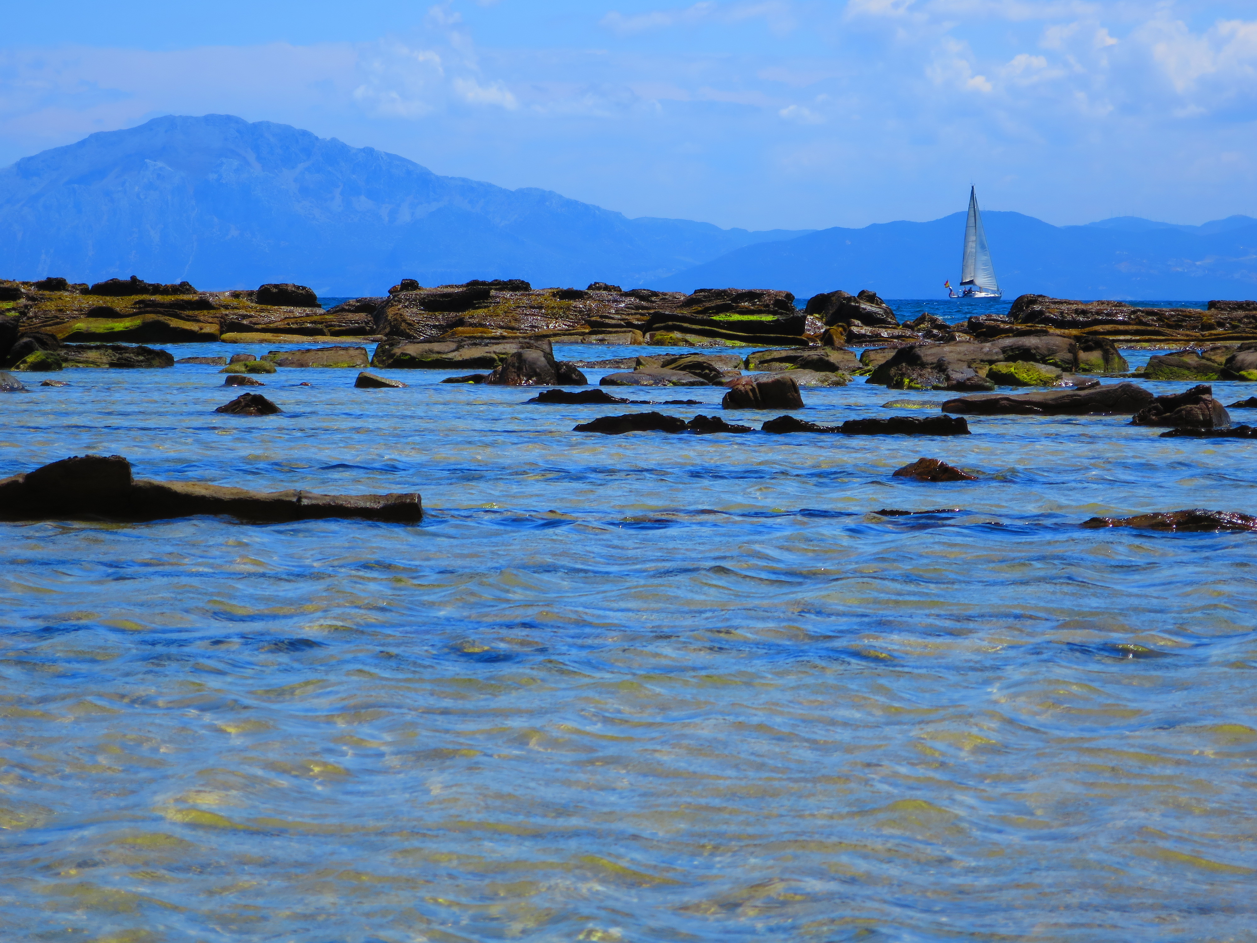
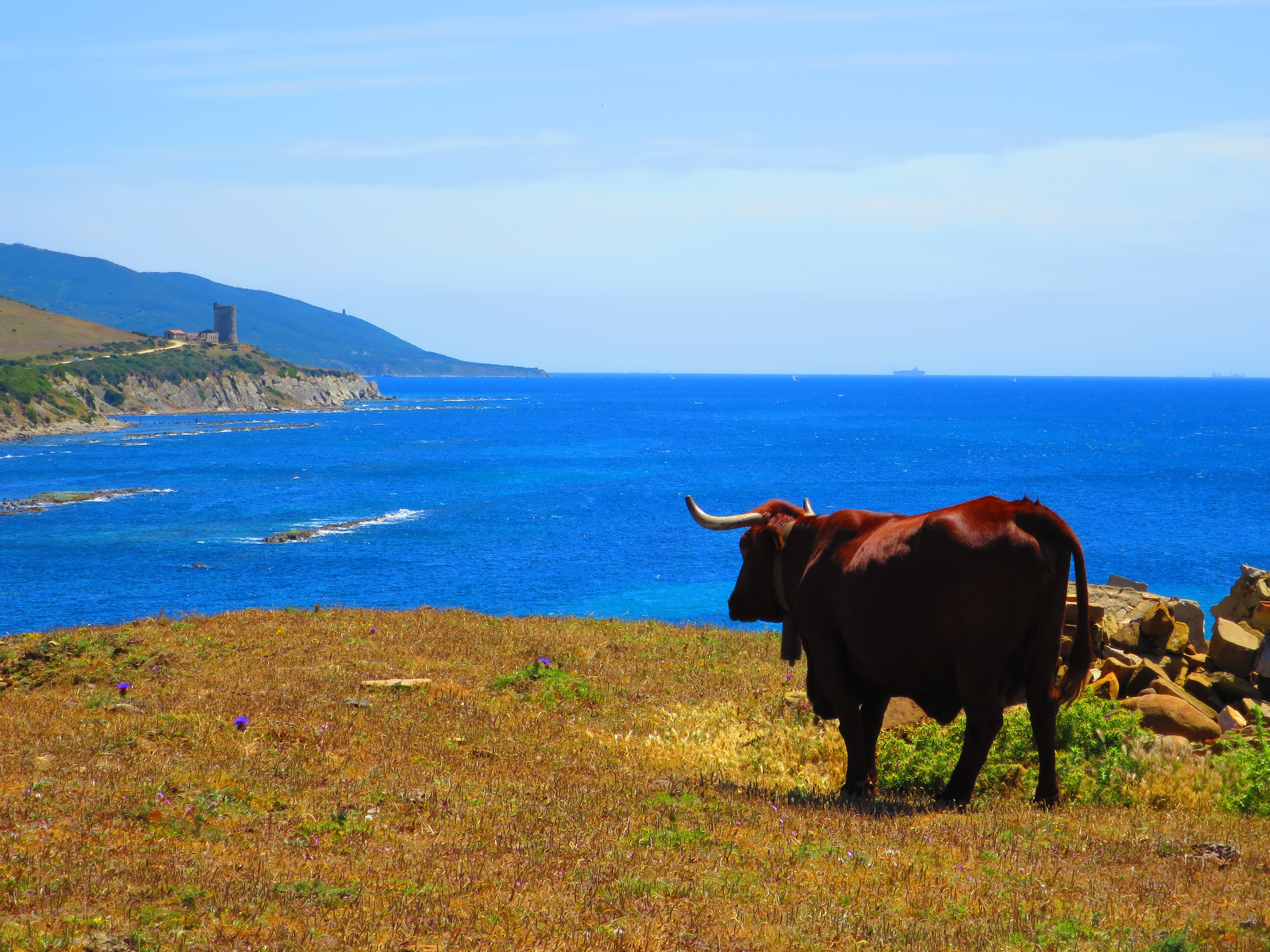
Afrika zum Greifen nah zur Rechten, eine eindrucksvolle, leicht mystische, weil wie von Künstlerhand ausgewaschene Steilküste zur Linken, den Leuchtturm von Tarifa im Rücken.
Und leichter Zugang zum flachen Meer für einen Sprung ins erfrischende Wasser.
Andalusische Rinder verteidigen die Grenze.
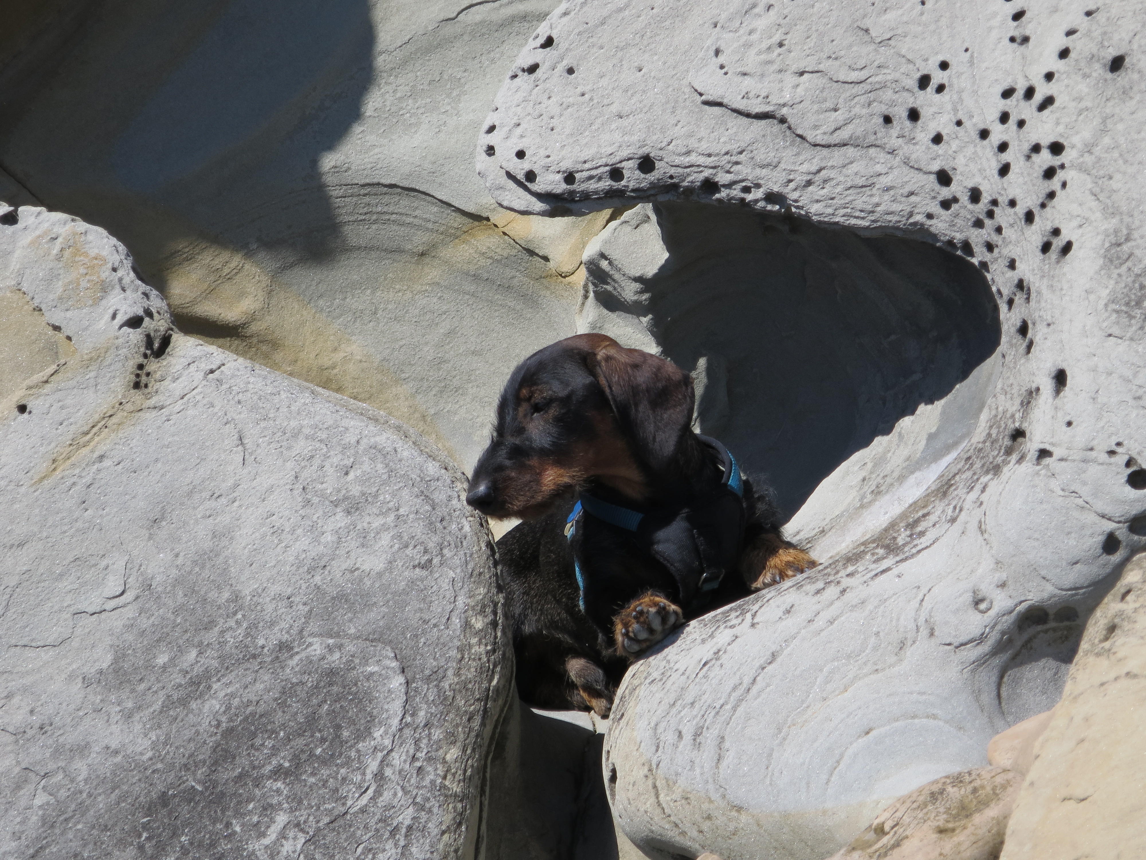
Und in den Höhlen am steinernen Strand lässt es sich wunderbar sonnenbaden.
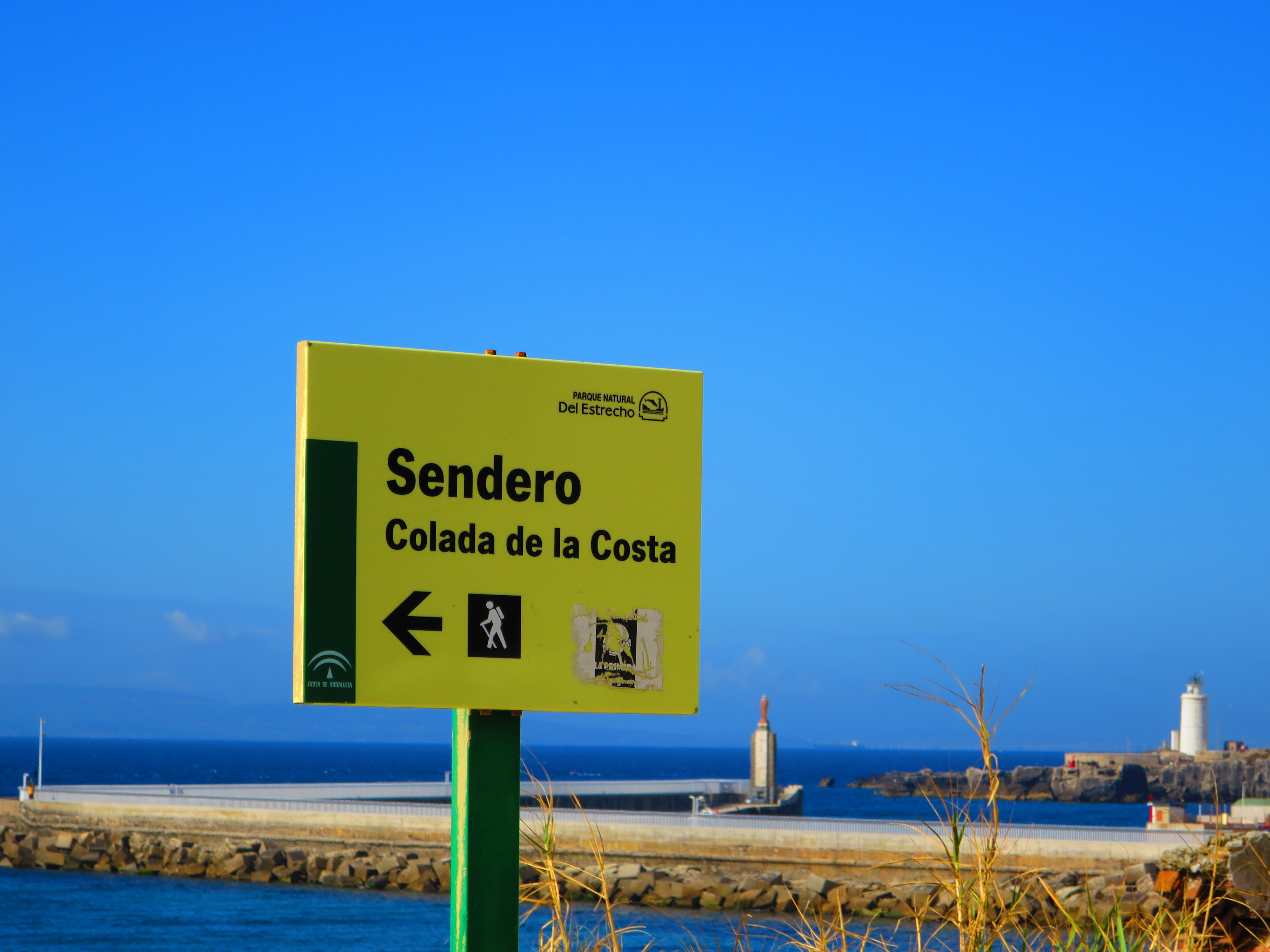
Strecke: Tarifa > Torre de Guadalmesí > Tarifa, 16 km
Höhenmeter: ein Auf und Ab von +/- 40 Metern
Fazit: Tarifa kann viel mehr als nur Wind und Wellen.

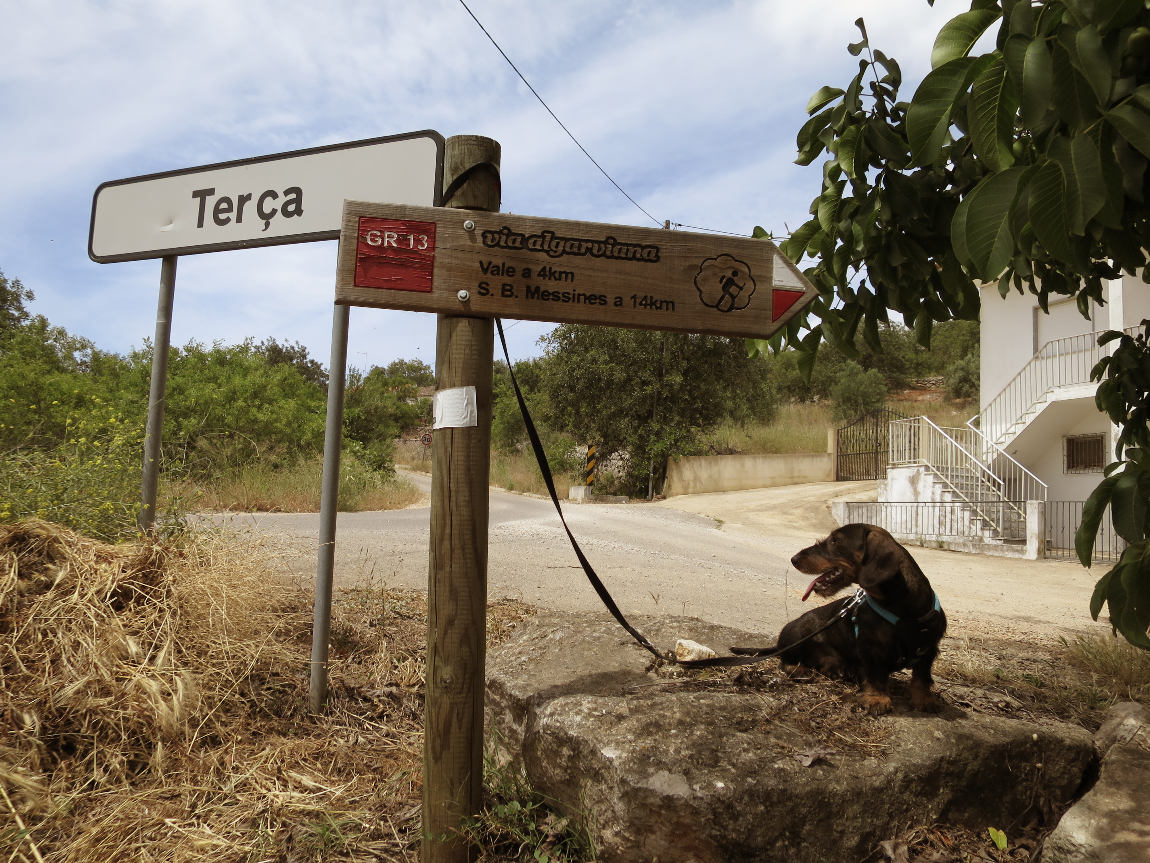
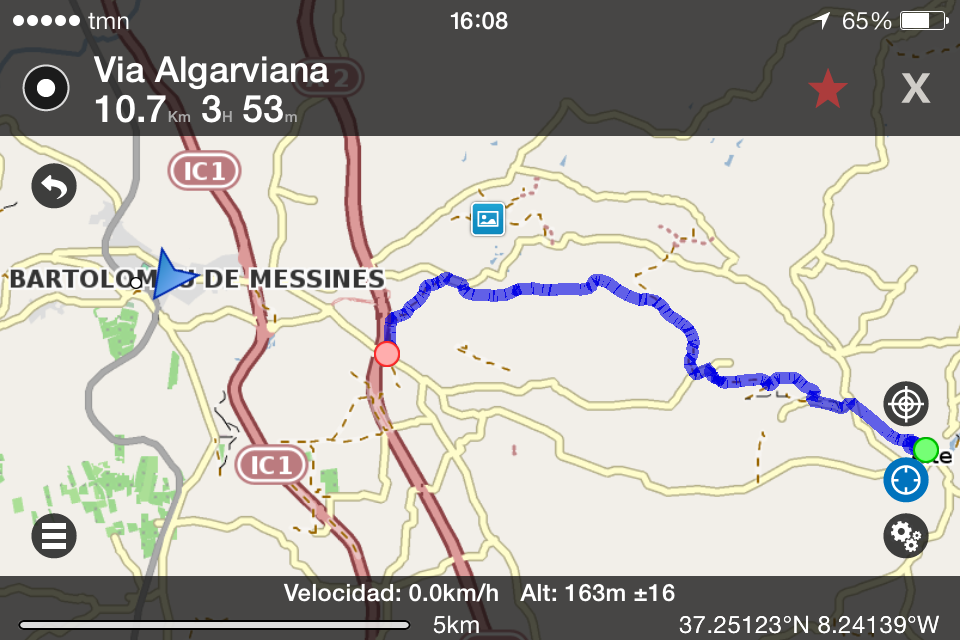
Strecke: Alte > São Bartolomeu de Messines, 11 km
Höhenmeter: 240
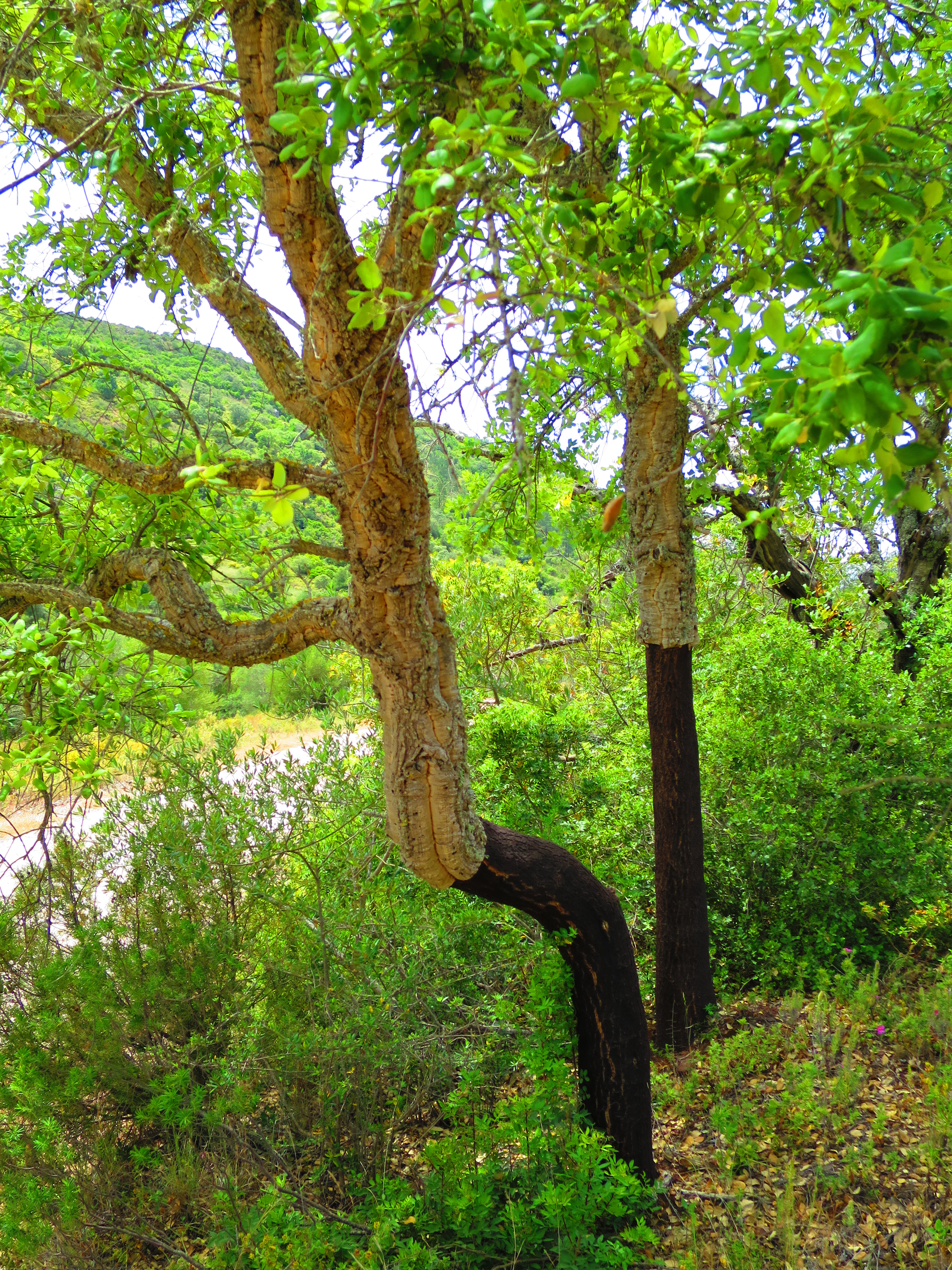
Fazit: In Portugal gedeiht praktisch alles direkt am Wegesrand, was man so braucht (für eine gepflegte Mahlzeit):
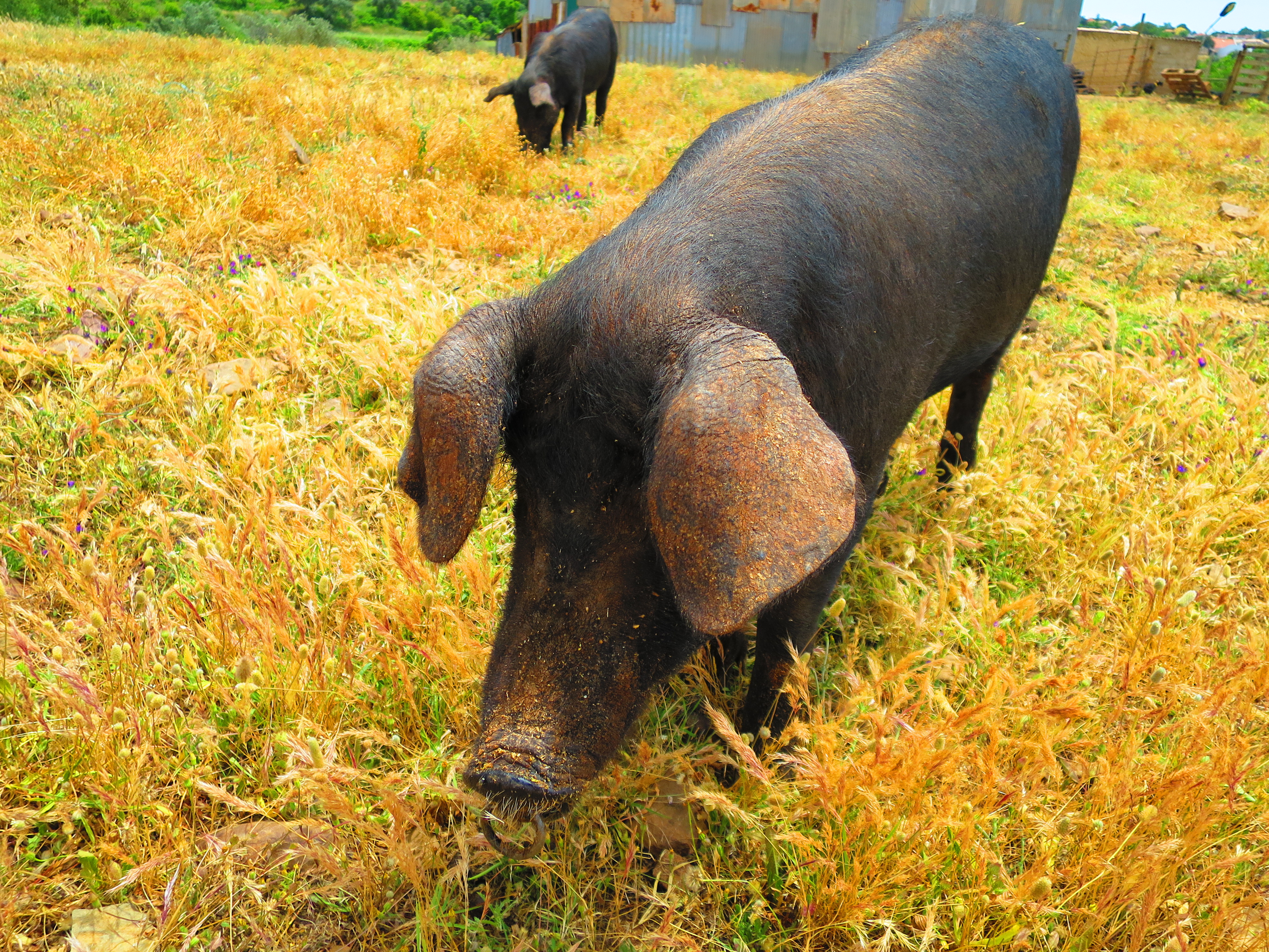
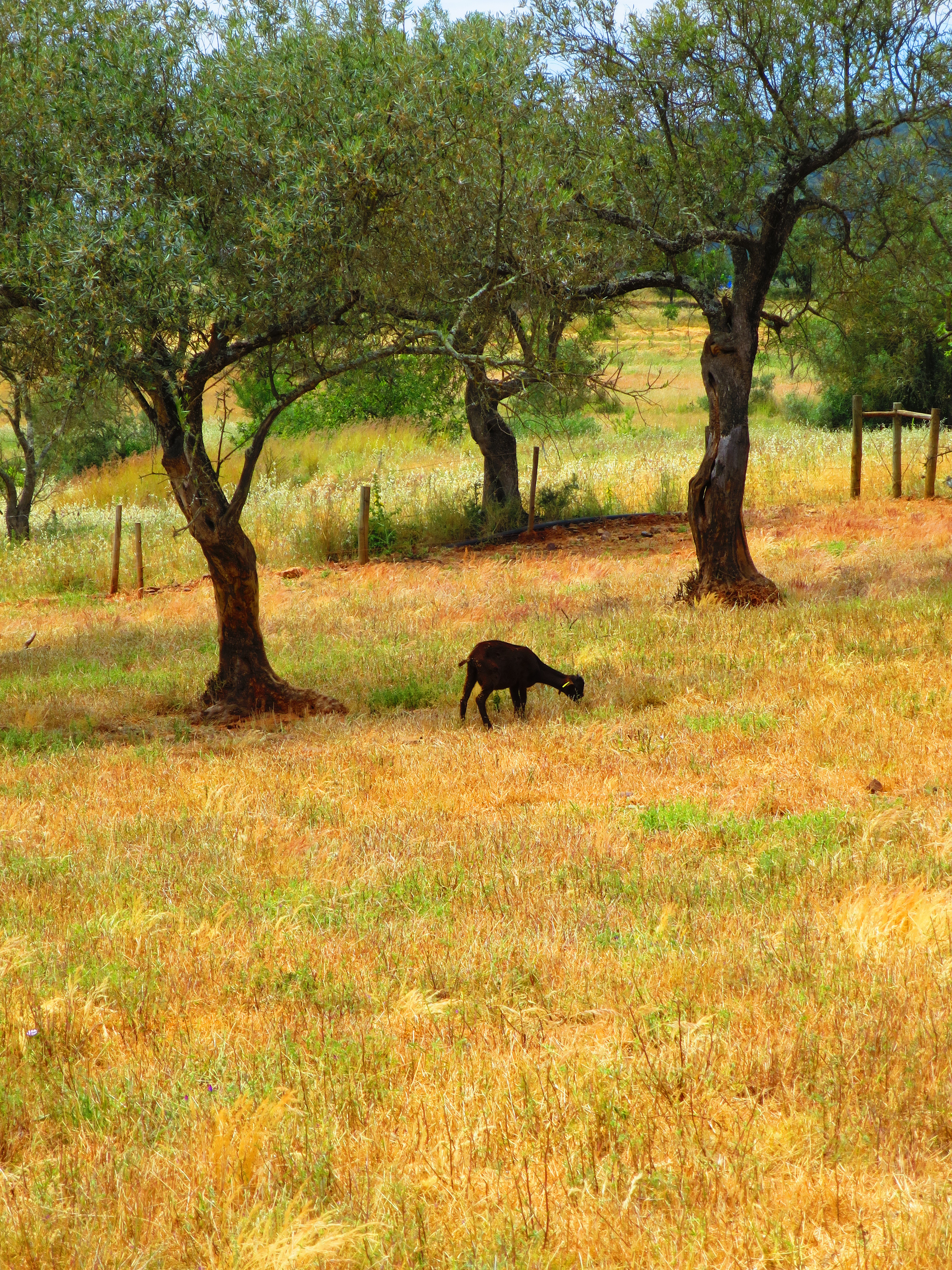
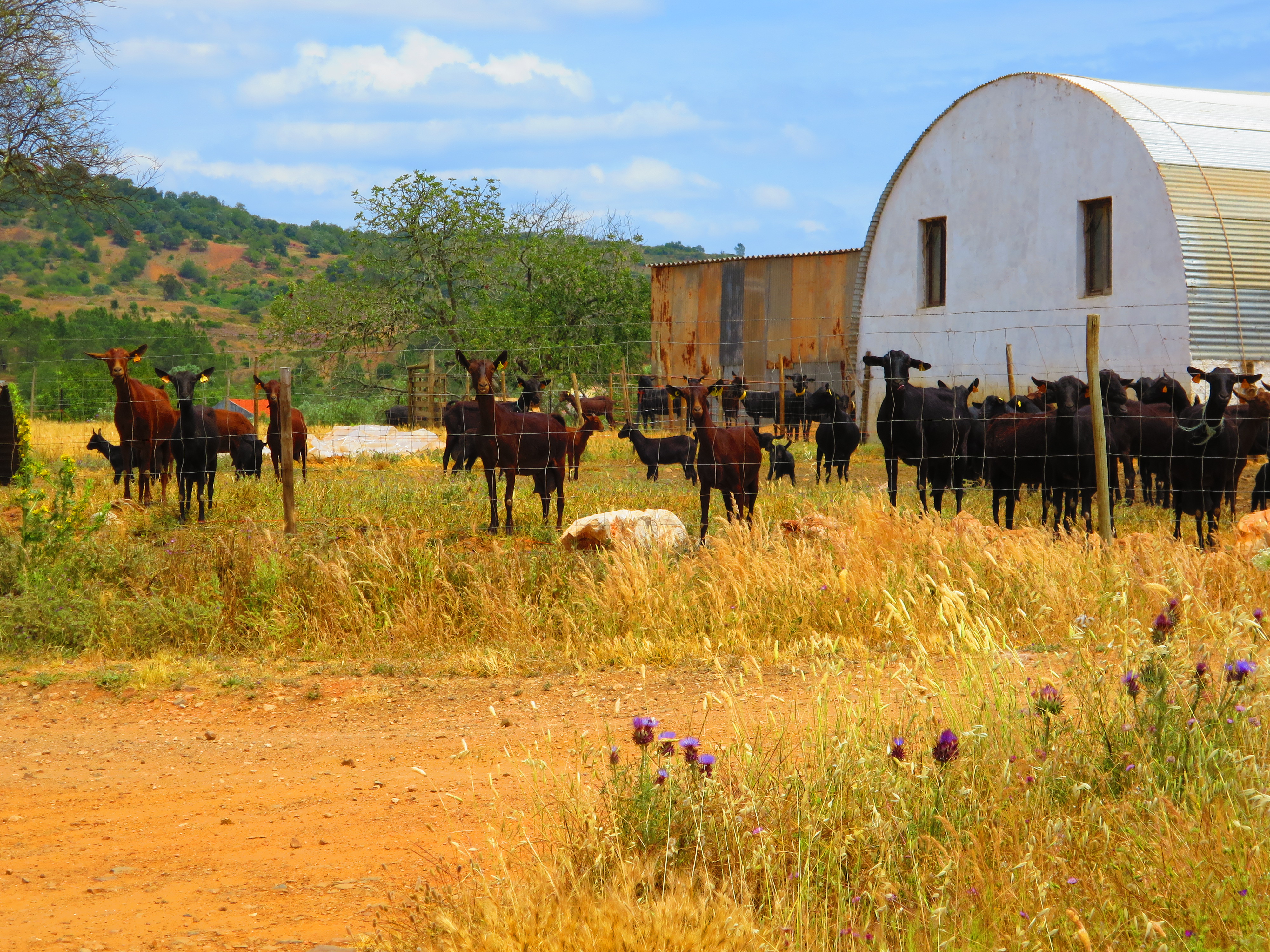
Die „Via Algarviana“ lohnt sich also trotz aller Anstrengung.
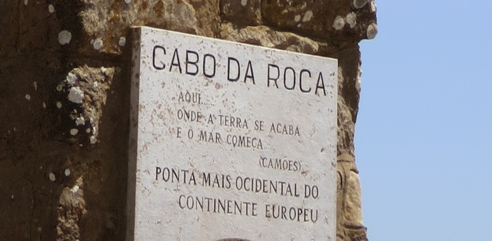
Das Ende von Europa erreicht. In diesem Fall das westliche.
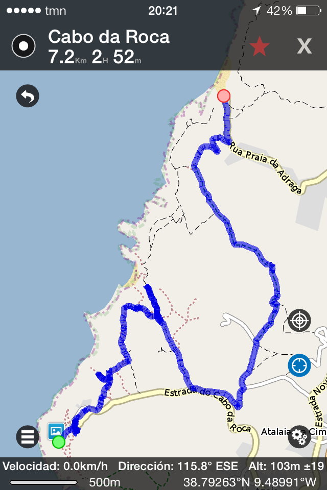
Strecke: Cabo da Roca > Praia da Adraga, 7 km
Höhenmeter: 280
Fazit: Tiefe Schluchten graben sich in den Westrand des Kontinents, was den Küstenweg spektakulär, aber nicht gerade einfach macht. Der Strand von Adraga belohnt dafür.
Vielleicht ist es etwas unchristlich, aber ich bin einen Teil des Jakobsweges – genauer gesagt den Camino del Norte, also eine der verschiedenen Varianten davon – heute in der „falschen“ Richtung gegangen. Das hat den Vorteil, dass man sich die Pilger, die einem da in Scharen entgegenkommen, mal genauer betrachten kann. Es waren allerdings weder Päpste, Mönche oder Entertainer à la Hape Kerkeling & Co. dabei, sondern nur Schulklassen und ganz normale Wanderer.
Aber der Weg an sich war spektakulär:
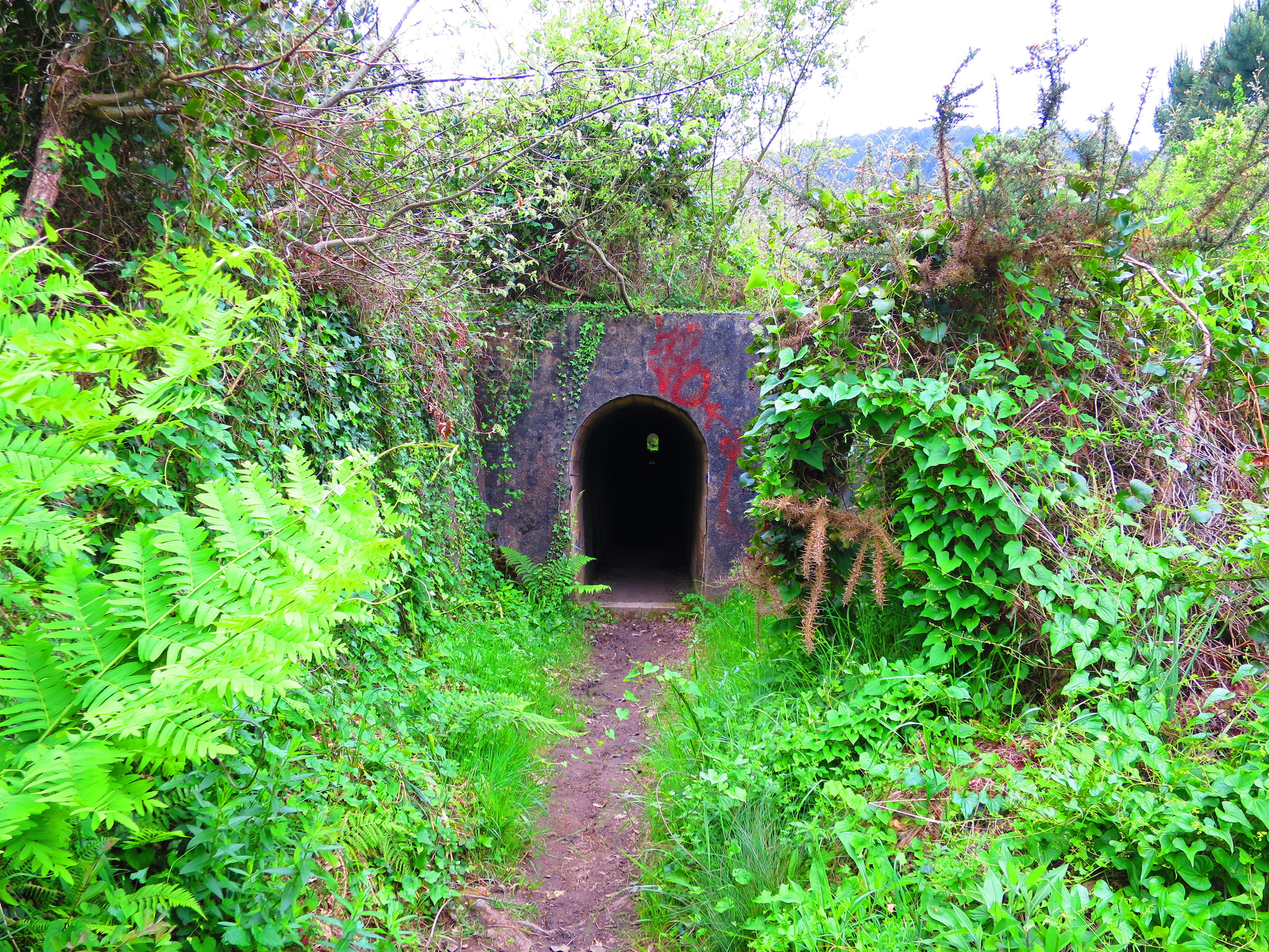
Mitten in der Wildnis haben sich die Jakobsjünger (oder wer auch immer) offenbar einen Tunnel gegraben, durch den der Weg führt.
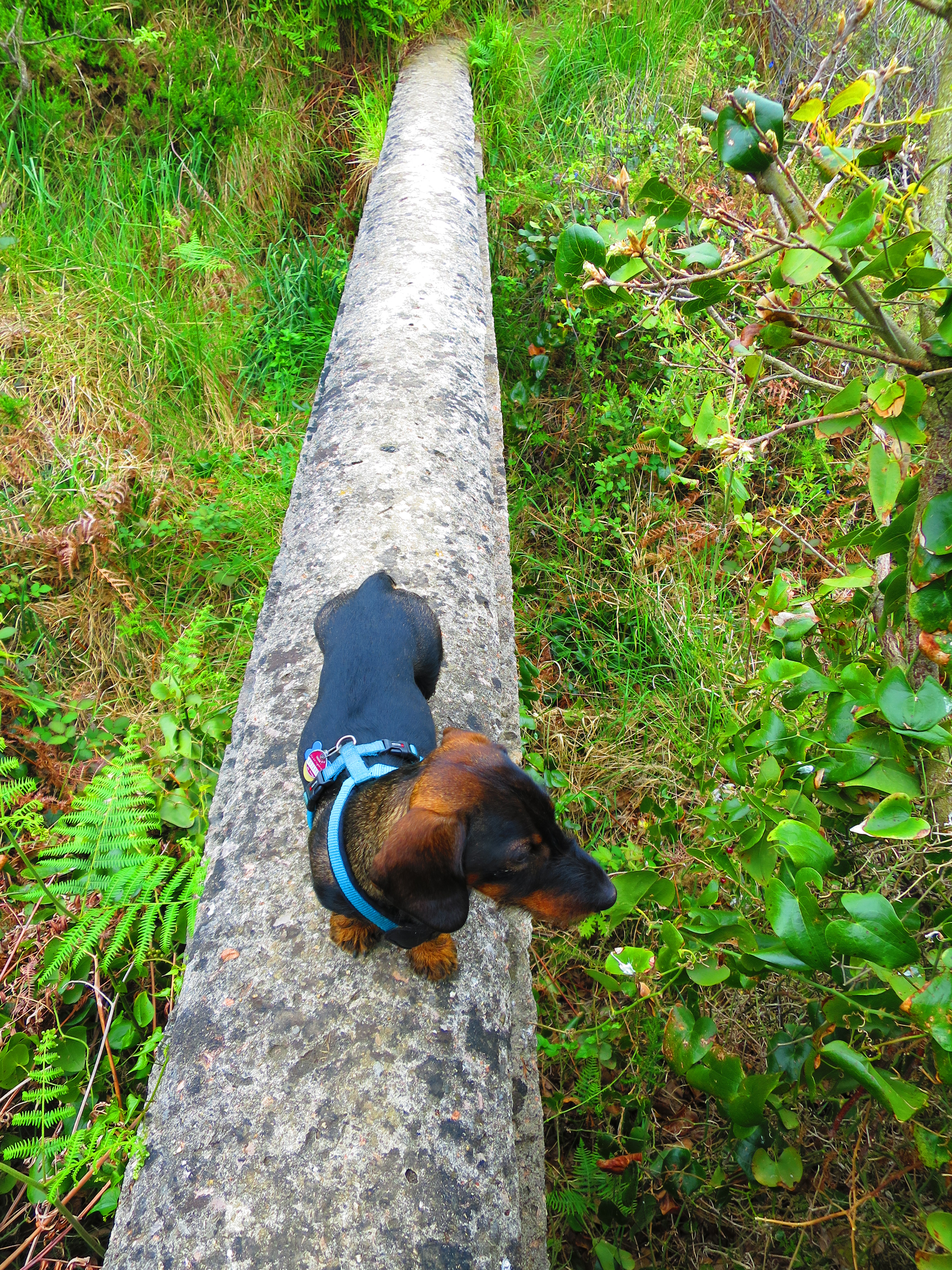
Die Brücken sind so schmal, dass kaum zwei Füße nebeneinander passen. Okay, kommt drauf an, welche Füße.
Und dann zählt trotzdem alles nicht als Pilgern. Unter 100 km gibt’s keinen „Pilgerpass“. Und beim Gehen in die falsche Richtung schon zweimal nicht.

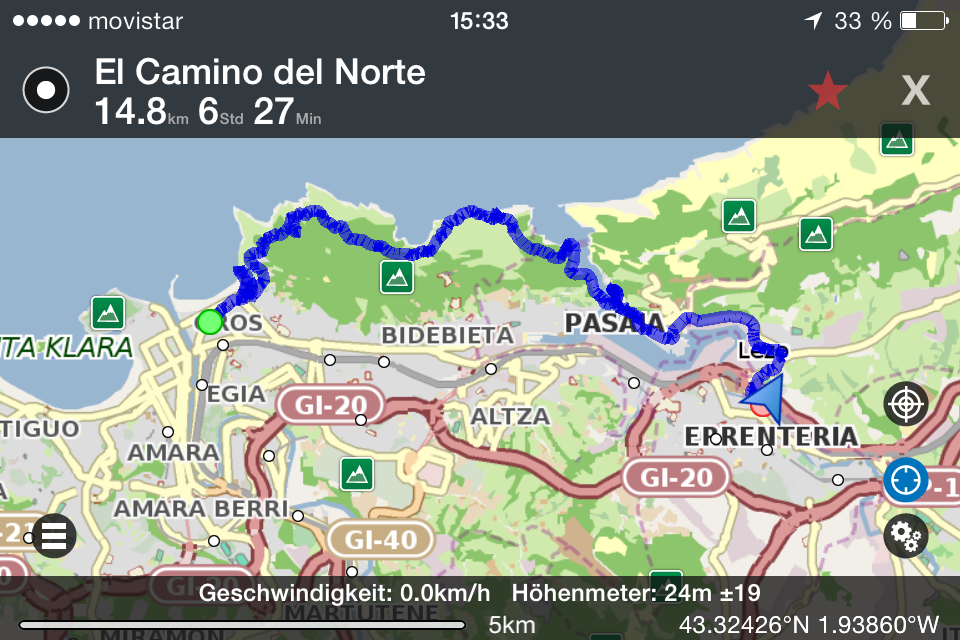
Strecke: Donostia-San Sebastián > La Plata (Leuchtturm) > Pasaia (Fähre über die Bucht) > Lezo-Errenteriako (Bahnhof), 15 km
Höhenmeter: 260
Fazit: Auch ein paar Schritte „rückwärts“ liefern phänomenale Steilküstenausblicke.
Strecke: La Teste (Bahnhof) > Dune de Pilat > Le Mouleau (Bus nach Arcachon), ca. 20 km
Höhenmeter: 110 (höchste Düne Europas)
Fazit: Sand macht Mühen beim Aufstieg. Aber der Abstieg direkt ins kühle Meer lohnt sich.